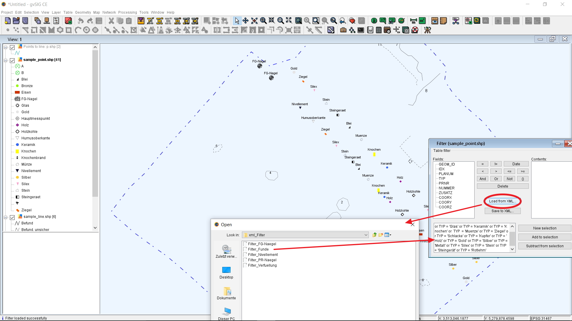
Figure 1: Screenshot of gvSIG-CE showing the use of pre-existing xml-scripts to filter features, finds and topographic points.
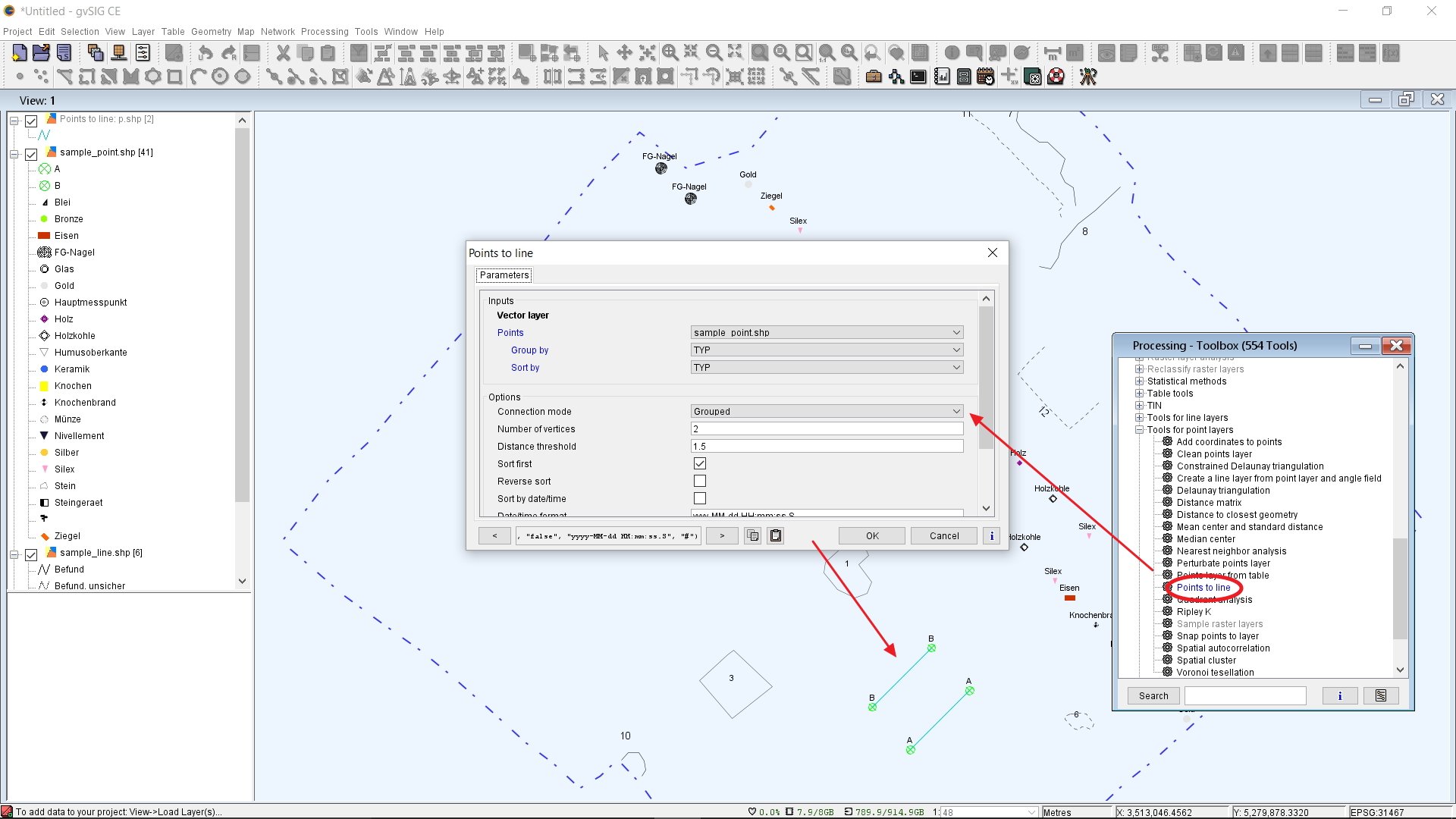
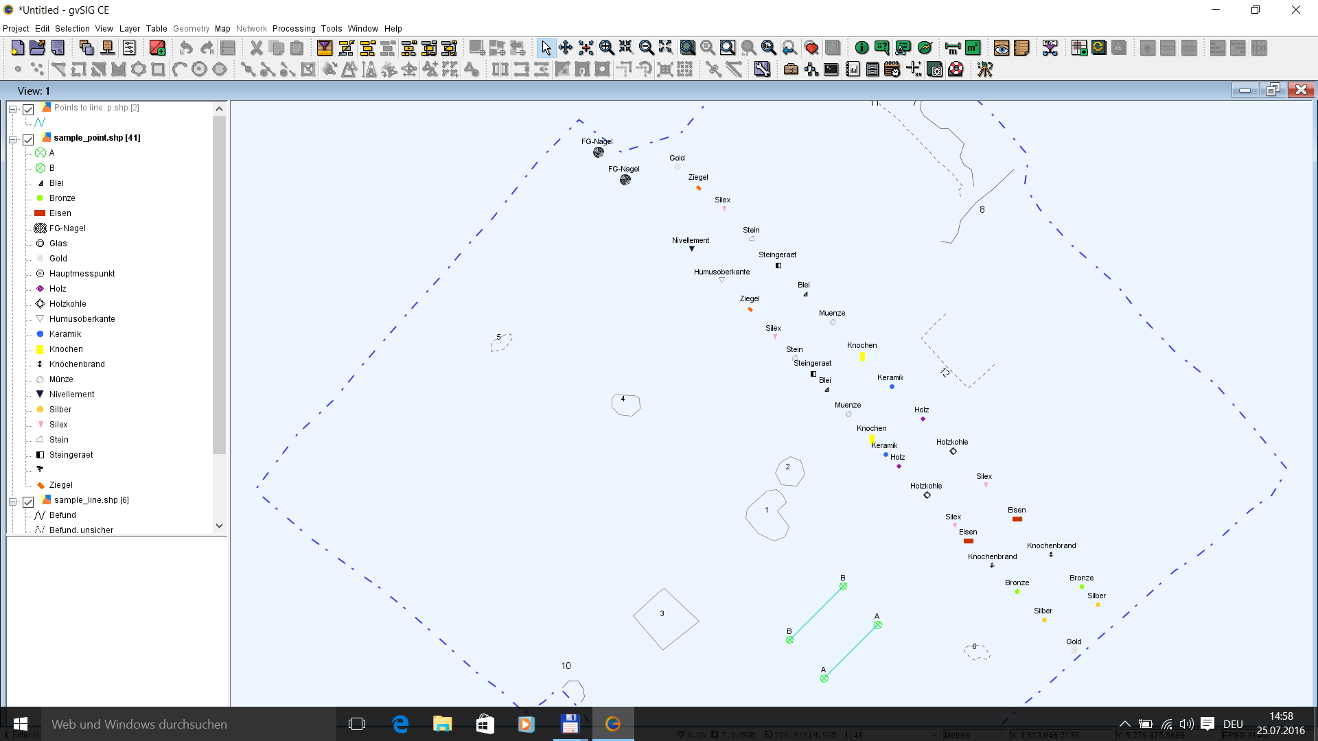
Figure 2: Screenshot of gvSIG-CE showing the use of onboard tools to create section lines between section nails recorded with Survey2GIS
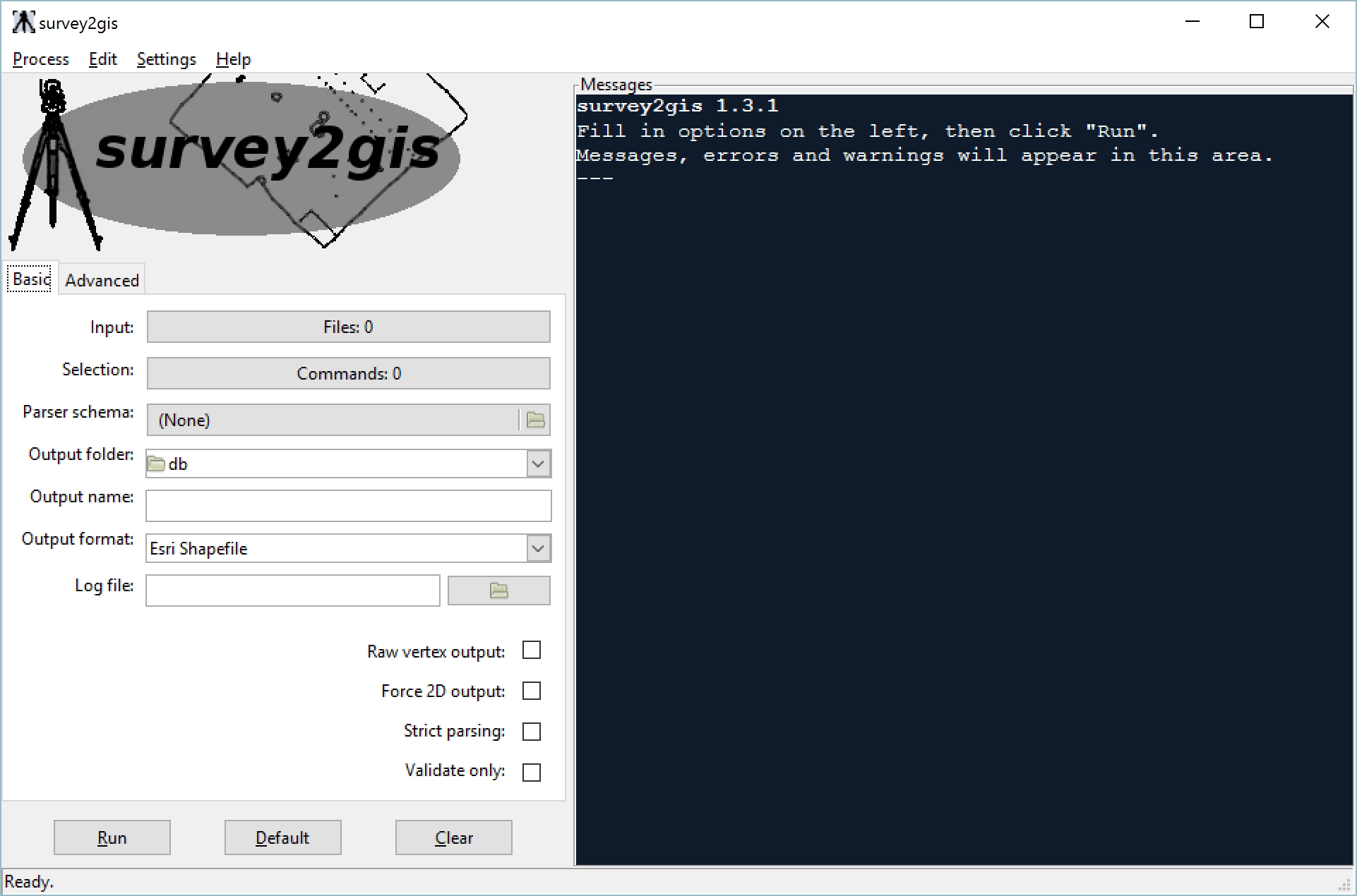
Figure 3: Screenshot of Survey2GIS, start up screen
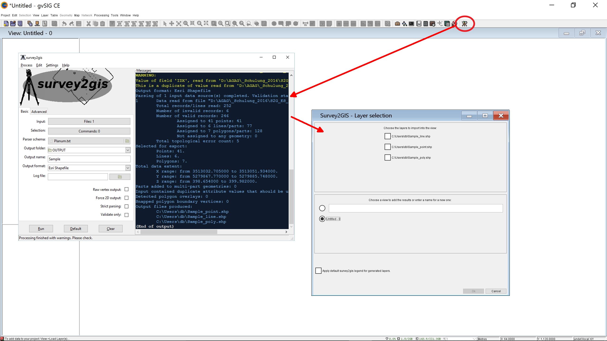
Figure 4: Survey2GIS integrating with gvSIG-CE. Processing field data
Figure 5: Fully attributed archaeological GIS-plan processed with survey2GIS/gvSG-CE
Internet Archaeology is an open access journal based in the Department of Archaeology, University of York. Except where otherwise noted, content from this work may be used under the terms of the Creative Commons Attribution 3.0 (CC BY) Unported licence, which permits unrestricted use, distribution, and reproduction in any medium, provided that attribution to the author(s), the title of the work, the Internet Archaeology journal and the relevant URL/DOI are given.
Terms and Conditions | Legal Statements | Privacy Policy | Cookies Policy | Citing Internet Archaeology
Internet Archaeology content is preserved for the long term with the Archaeology Data Service (ROR). Help sustain and support open access publication by donating to our Open Access Archaeology Fund.