Cite this as: Gaffney, V., Baldwin, E., Allaby, R., Bates, M., Bates, R., Finlay, A., Gaffney, C., Hansford, T., Kinnaird, T., Neubauer, W., Löcker, K., Sparrow, T., Trinks, I., Wallner, M. and Ch’ng, E. 2025 The Perils of Pits: further research at Durrington Walls henge (2021-2025), Internet Archaeology 69. https://doi.org/10.11141/ia.69.19
Ruggles and Chadburn (2024, 104) highlight a number of adjacent features as potentially significant when considering the published data on the Durrington Pit Circle (Gaffney et al. 2020). They specifically suggest that the lack of information on these sites undermines the interpretation of the anomalies identified here as part of a larger pit structure. These features, indicated by roman numerals in Figure 10.1, are not in fact the sum of potential archaeological features adjacent to the southern section of the Durrington pit circle. However, those selected by Ruggles and Chadburn were based solely on their presence within the Historic England – National Heritage List for England (NHLE) portal (https://historicengland.org.uk/listing/the-list/map-search), i.e. scheduled monuments.
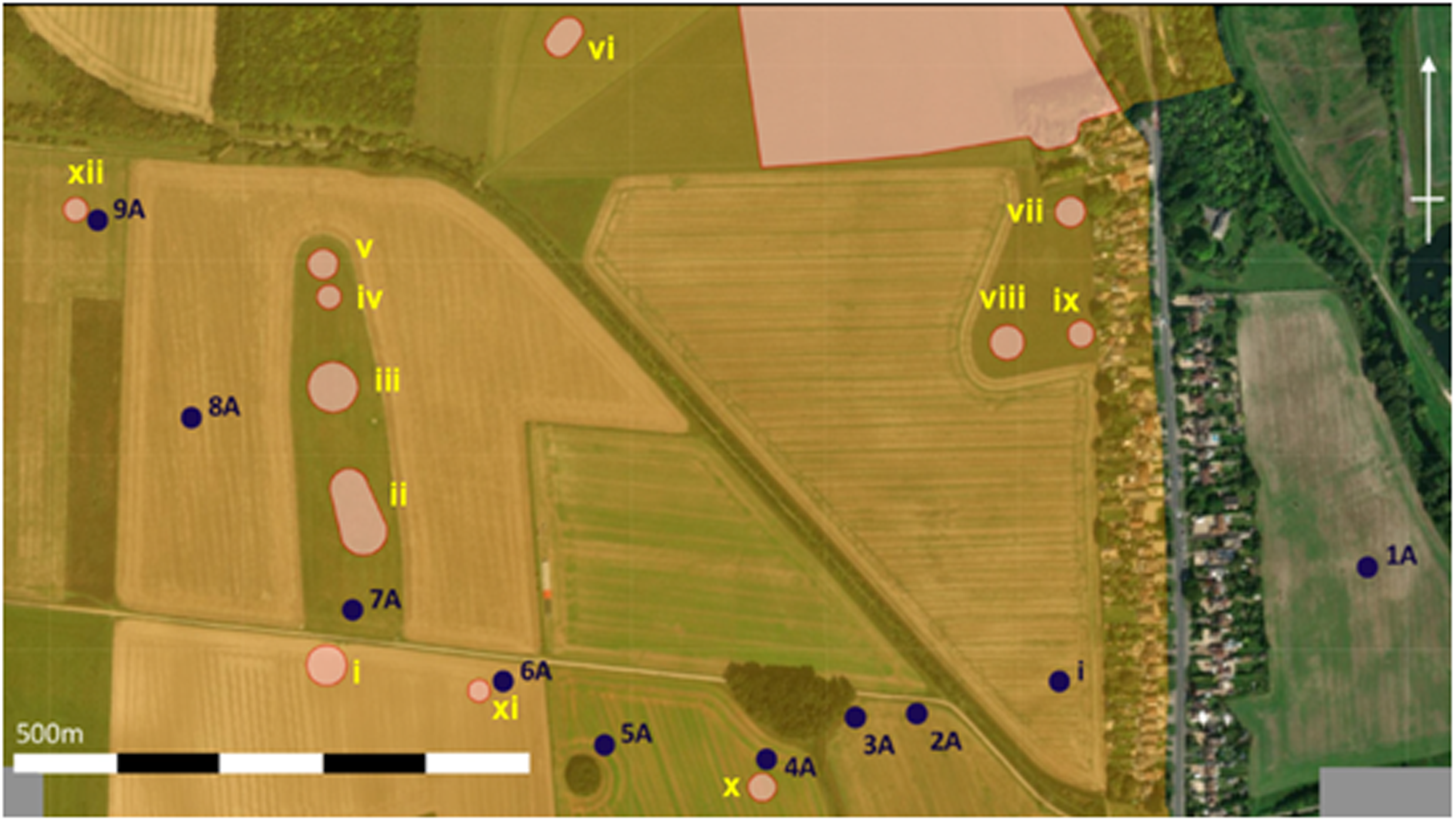
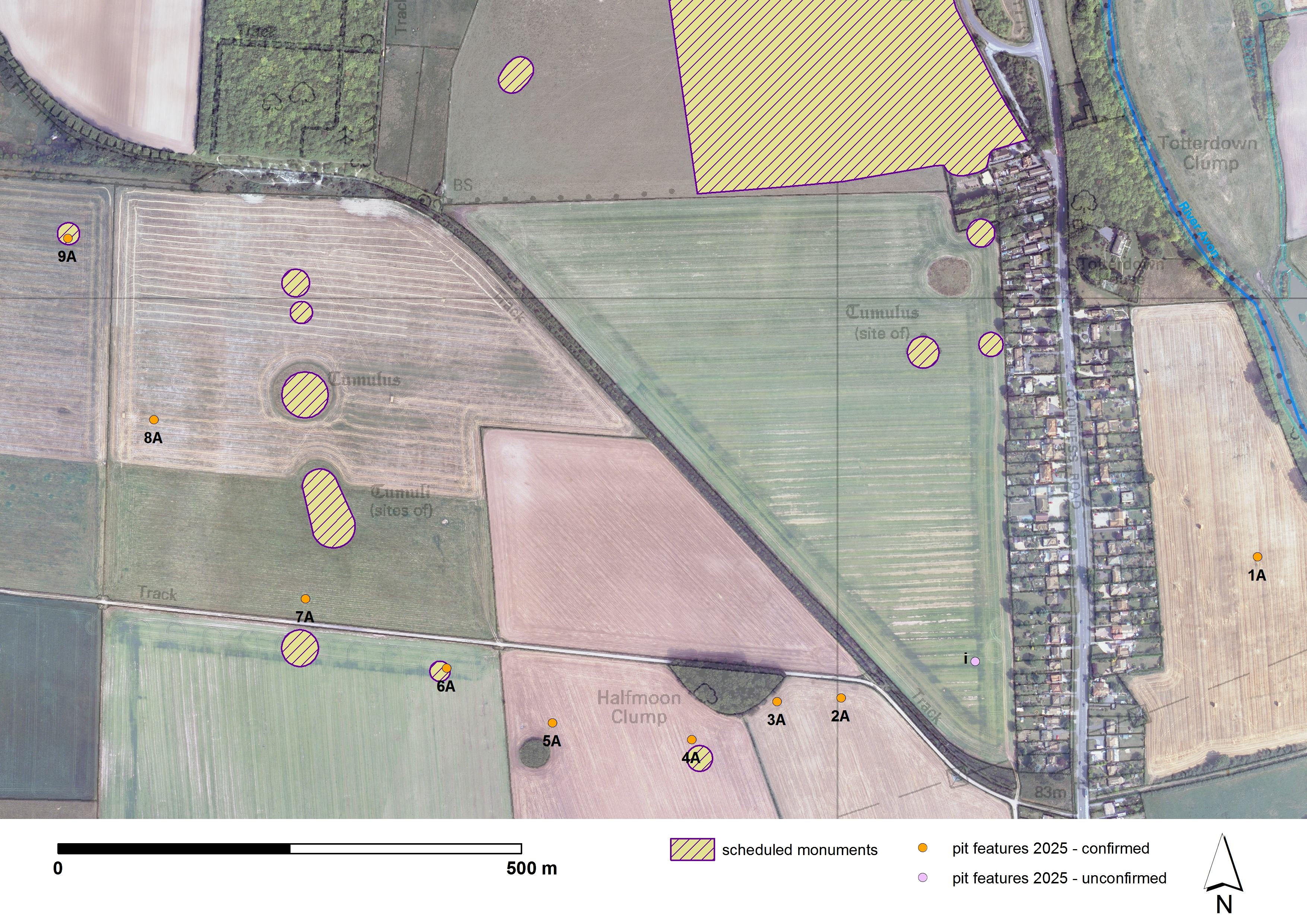
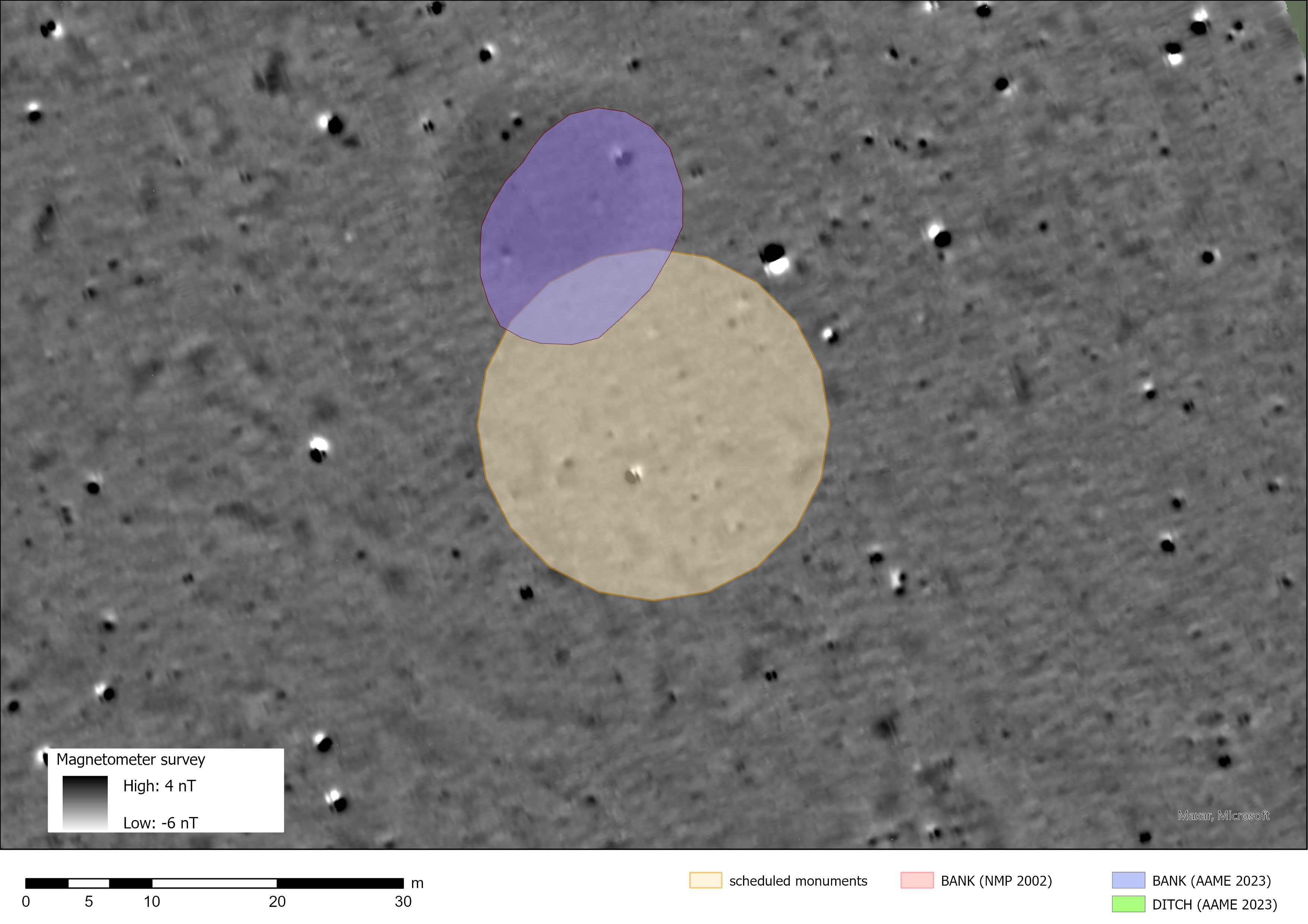
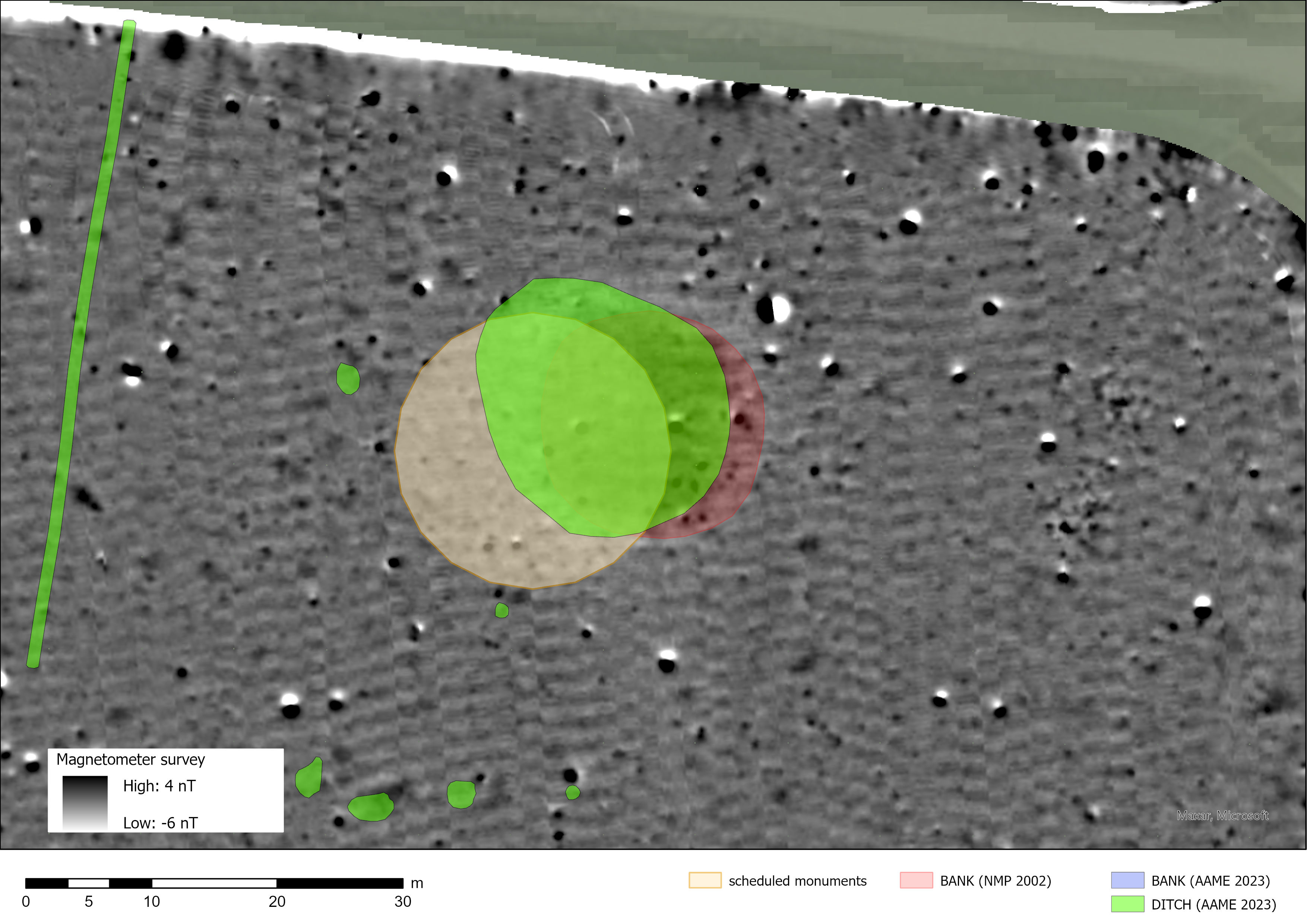
Three of these features, identified as X (1009138), XI (1009137) and XII (1009145) in Figure 10.1, clearly relate to pits 4A, 6A and 9A. And any locational discrepancies must result from a combination of (a) positional errors between the aerial photo transcriptions and the areas of scheduling (see Figs 10.3–10.5), and (b) the inaccurate georeferencing of anomalies 1A–9A by Ruggles and Chadburn (2024, fig. 3) – i.e. compare Figures 10.1 and 10.2.
As the whole of this area has been surveyed as part of the Stonehenge Hidden Landscapes project, the relevant detail from the earlier survey has been included in Table 10.1 (Gaffney et al. 2012; 2018).
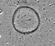
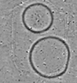
Consideration of these images demonstrates that, aside from features X (1009138), XI (1009137), and XII (1009145), which were identified as pits from fieldwork, the remaining features comprise a series of ring ditches and enclosures. These cannot be compared to those identified as pits following detailed survey, and their use as part of a critique of the previous paper cannot be substantiated (Gaffney et al. 2020).
| Number on Figure 10.1 | Magnetometry Plot (image not to scale) | Historic England Heritage List Entry No. | Historic England Description and Supplementary Notes |
|---|---|---|---|
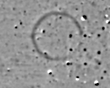
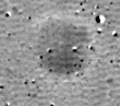
| i |
|
1009150 | Bowl barrow 500m north of the A303 on Countess Farm |
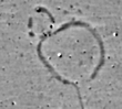
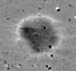
| ii |
|
1009135 | Two bowl barrows 800m north-east of The Avenue on Countess Farm |
| iii |
|
1009134 | Multi-ditch enclosure, previously identified as a bowl barrow |
| iv |
|
1009134 | Pond barrow 400m south-east of Strangways |
| v |
|
1021348 | Bowl barrow 510m south-east of Strangways on Countess Farm |
| vi |
|
1009130 | Long barrow 450m WSW of Woodhenge |
| vii |
|
1009131 | Bowl barrow 70m west of A345 on Countess Farm |
| viii |
|
1009140 | Enclosure with segmented ditch feature. Identified as bowl barrow 150m west of A345 on Countess Farm |
| ix |
|
1009141 | Multi-ditch feature identified as bowl barrow 60m west of A345 on Countess Farm |
| x |
|
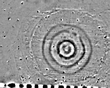
1009138 | Bowl barrow 400m north of the A303 on Countess Farm. Now identified as Pit 4A (Gaffney et al. 2020) |
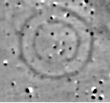
| xi |
|
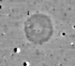
1009137 | Bowl barrow 450m north of the A303, on Countess Farm. Now identified as Pit 6A (Gaffney et al. 2020) |
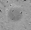
| xii |
|
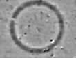
1009145 | Bowl barrow 170m south-east of Strangways on Countess Farm. Now identified as Pit 9A (Gaffney et al. 2020) |
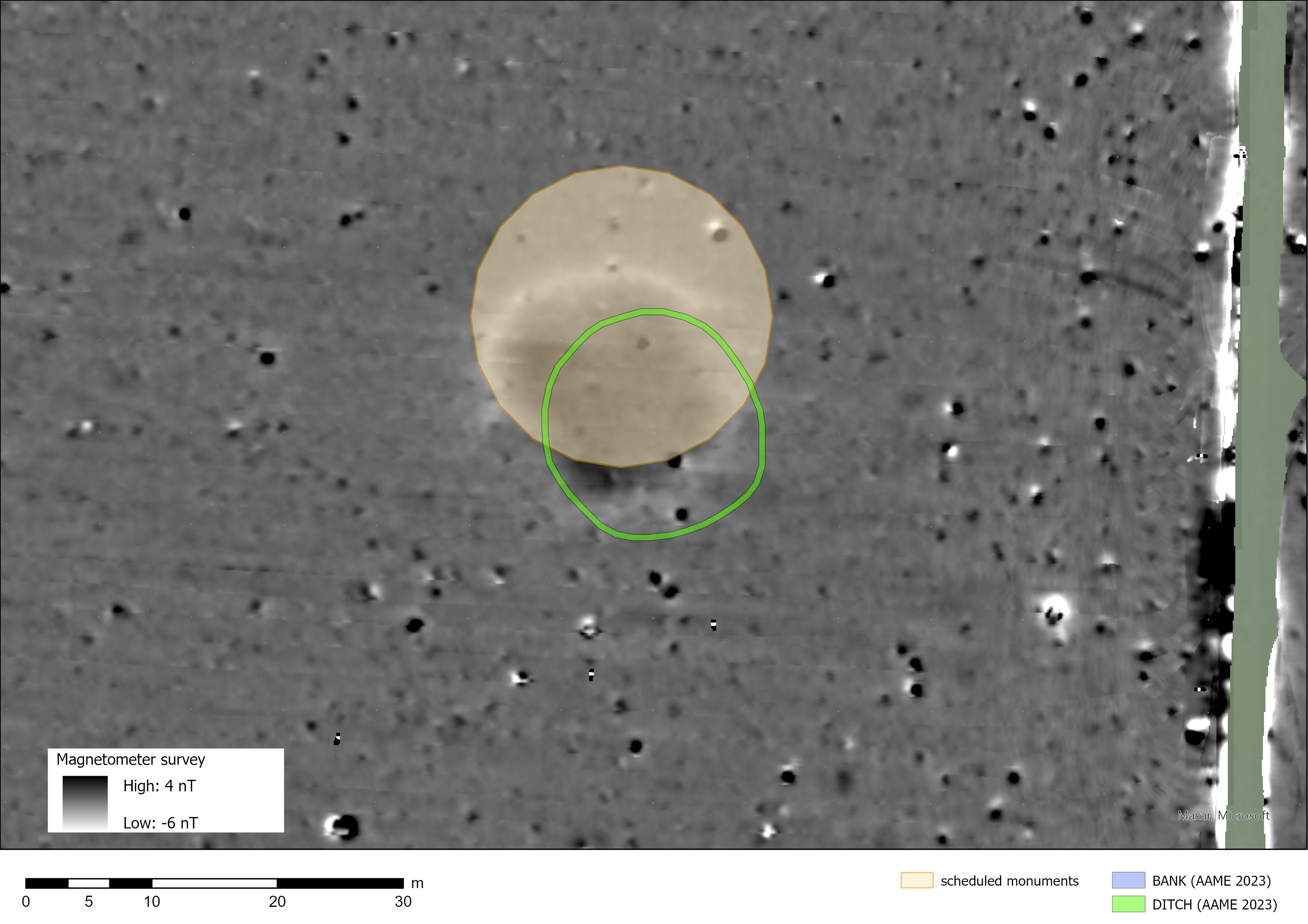
Figures 10.3–10.5 highlight positional discrepancies between the areas of monument scheduling and the National Mapping Programme (NMP) transcripts (Crutchley 2002 – now superseded by the Aerial Archaeology Mapping Explorer (AAME) portal (2023). The aerial transcript data are a much closer positional fit to the magnetometer results than the scheduled areas. The Historic England National Heritage List Entry descriptions either don't reflect the aerial transcripts and/or possibly seem to be based on data not publicly available (e.g. 1009138 – 4A).
A summary of available source materials for scheduled features X, XI and XII – 4A (1009138), 6A (1009137) and 9A (1009145) follows.
Available source material
National Heritage List Entry – 1009138 [4A] – Date first listed: 12 April 1995:
'The monument includes a levelled bowl barrow located 400m north of the A303, 50m south west of Halfmoon Clump and is situated on a raised plateau which lies between the River Avon and Stonehenge. The barrow mound is now difficult to identify on the ground. However, it is visible as a circular chalk spread on aerial photographs from which the diameter has been calculated to be c.20m. Surrounding the mound is a ditch from which material was quarried during its construction. This has become infilled over the years but survives as a buried feature c.2m wide, giving the barrow an overall diameter of c.24m'' (Historic England 2024).
Observation – the National Heritage List Entry description of a surrounding ring ditch seems at odds with both aerial interpretation (Crutchley 2002; AAME 2023) and the results of the magnetometer survey (Gaffney et al. 2020).
Available source material
National Heritage List Entry 1009137 [6A] – Date first listed 12 April 1995:
'The monument includes a levelled bowl barrow located 450m north of the A303, north west of Countess Farm buildings and situated on a raised plateau which lies between the River Avon and Stonehenge. The barrow mound is now difficult to identify on the ground. However, it is visible as a circular cropmark on aerial photographs from which the diameter is calculated to be 15m. Surrounding the mound is a ditch from which material was quarried during its construction. This has become infilled over the years but survives as a buried feature c.1.5m wide, giving the barrow an overall diameter of c.18m' (Historic England 2024).
Observation – the National Heritage List Entry description of a surrounding ring ditch seems at odds with both AAME (2023) and NMP (Crutchley 2002) interpretations, as well as the results of the magnetometer survey (Gaffney et al. 2020).
Available source material
National Heritage List Entry 1009145 [9A] – Date first listed: 25 April 1995:
'The monument includes a levelled bowl barrow located 170m south east of Strangways, north west of Countess Farm buildings, situated on a broad plateau which lies between the valley of the River Avon and Stonehenge. The barrow mound is now difficult to identify on the ground. However, the ditch, which surrounds the mound, and from which material was quarried during its construction survives as a buried feature and is visible on aerial photographs from which the overall diameter of the barrow can be calculated to be 20m' (Historic England 2024).
Observation – the magnetic survey results do not support the aerial photography-based interpretation of a ring ditch at this location.
The magnetometer survey results (Gaffney et al. 2020) do not support the interpretation of the three scheduled Features X (1009138 – 4A), XI (1009137 – 6A) and XII (1009145 – 9A) as bowl barrows, as no magnetic evidence for surrounding ring ditches was revealed. Rather, the magnetic results reveal the presence of three large pit-like anomalies at these locations.
In the cases of X (1009138 – 4A) and XI (1009137 – 6A), neither the AAME (2023) nor NMP (Crutchley 2002) transcript data provide any evidence of a surrounding ditch for either feature as listed in the NHLE description.
Furthermore, at Feature XII (1009145 – 9A), the interpreted 'ring-ditch' of the aerial transcripts (Crutchley 2002; AAME 2023) contrasts with the magnetometer results, which clearly reveal no magnetic evidence of a 'ring-ditch' feature, only a large 'pit-like' response. Interestingly, the NMP interpretation is based on two air photos from the early to mid-1970s which presumably would have been available to the RCHME (NMR OS/70130 399-400 24-MAY-1970 and NMR SU 1442/25/190 (968/190) 18-JUL-1976) – however, no evidence for a ring ditch was documented by the RCHME (1979) at this location.
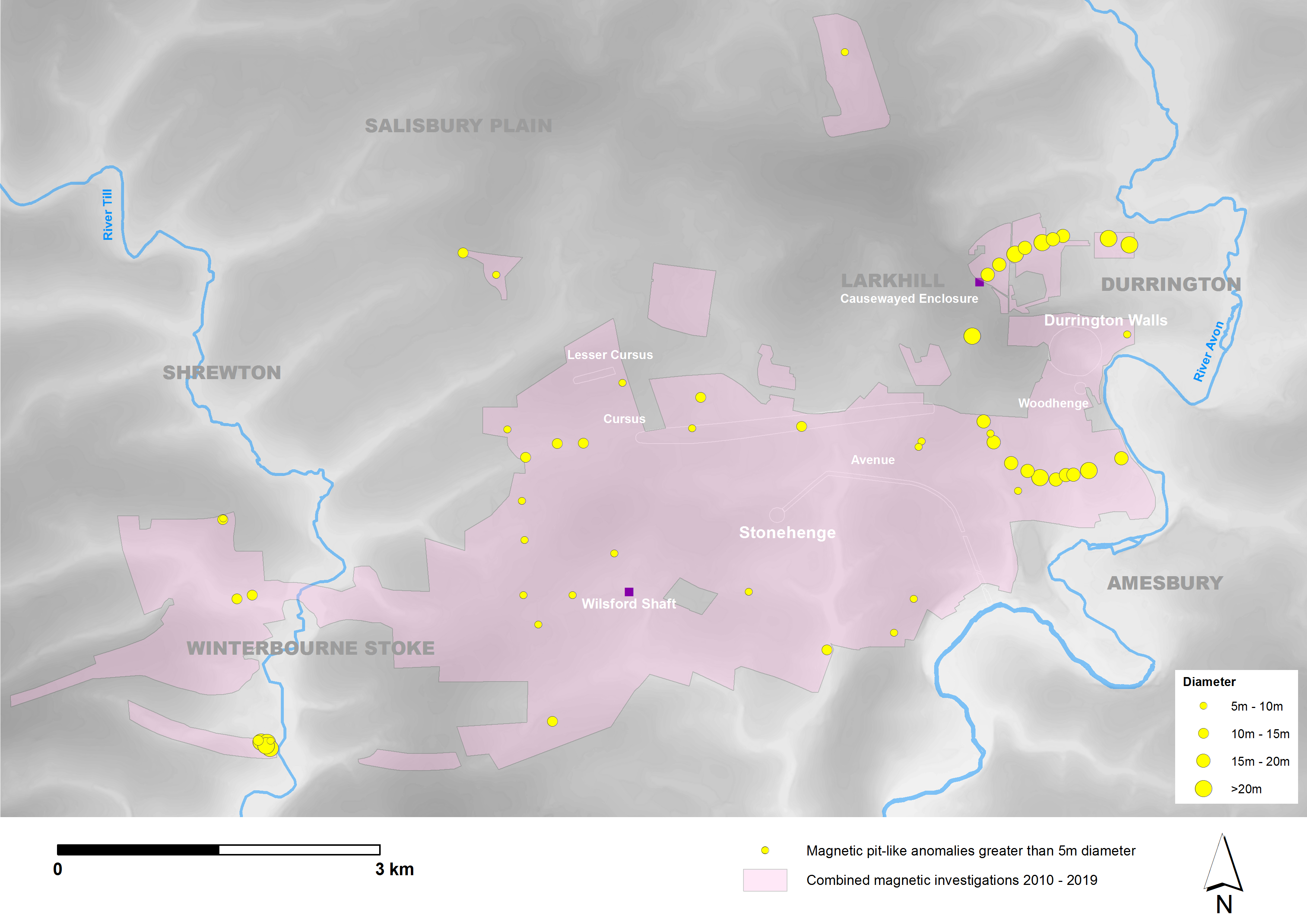
The initial publication on the pit alignment contained a figure illustrating the distribution of probable and potential pit features over 5m in diameter (Gaffney et al. 2020, figure 9). This distribution was provided from the c. 18.4km² of landscape subject to geophysical survey undertaken for archaeological purposes over many years. When published, it was decided that the unique geometry of the Durrington group was largely self-evident. The alignment is set apart as a visually coherent group, largely reflecting the shape of the Durrington Walls Henge. The significance of this data has been supplemented in Figure 10.6 which now illustrates the distribution of pits along with information on the diameter of these features. Large, individual pits exist across the Stonehenge landscape. For example, those Mesolithic features excavated near Stonehenge (De Smedt et al. 2022). However, the character of the Durrington group stands out against the background distribution of substantive pits and further emphasises the unique nature of the group and its significance in respect of large, prehistoric circular structures both in Britain and across Europe (Bradley 2012).
Internet Archaeology is an open access journal based in the Department of Archaeology, University of York. Except where otherwise noted, content from this work may be used under the terms of the Creative Commons Attribution 3.0 (CC BY) Unported licence, which permits unrestricted use, distribution, and reproduction in any medium, provided that attribution to the author(s), the title of the work, the Internet Archaeology journal and the relevant URL/DOI are given.
Terms and Conditions | Legal Statements | Privacy Policy | Cookies Policy | Citing Internet Archaeology
Internet Archaeology content is preserved for the long term with the Archaeology Data Service (ROR). Help sustain and support open access publication by donating to our Open Access Archaeology Fund.
 Home
Home