
Cite this as: Tuck, A. 2025 'A State of Things Which Ought Not to be Permitted': Excavation of 19th-century slums (Bull Yard, Horn Yard, Swan Yard and Market Alley) surrounding Bank Street at 'The Charter', Gravesend, Internet Archaeology 69. https://doi.org/10.11141/ia.69.11
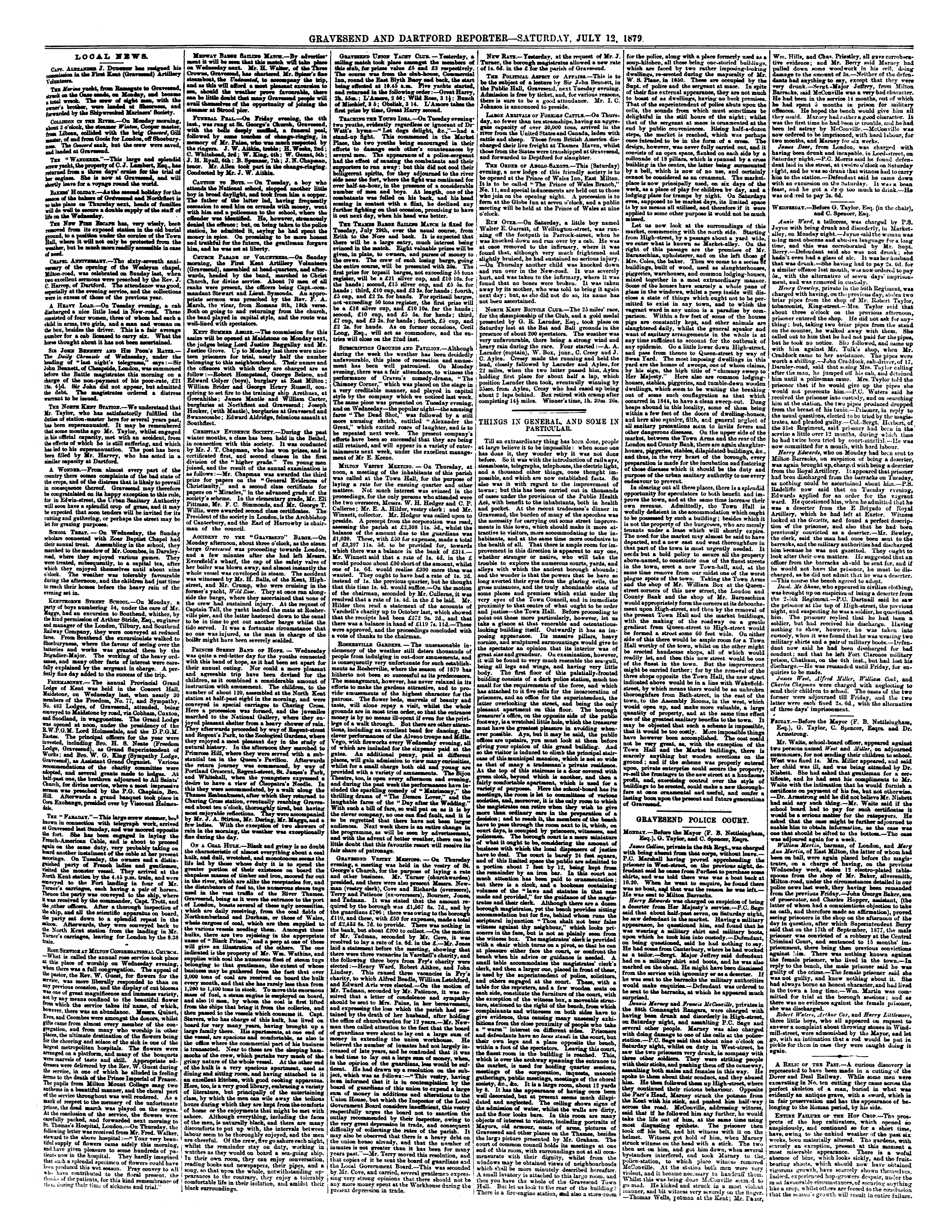
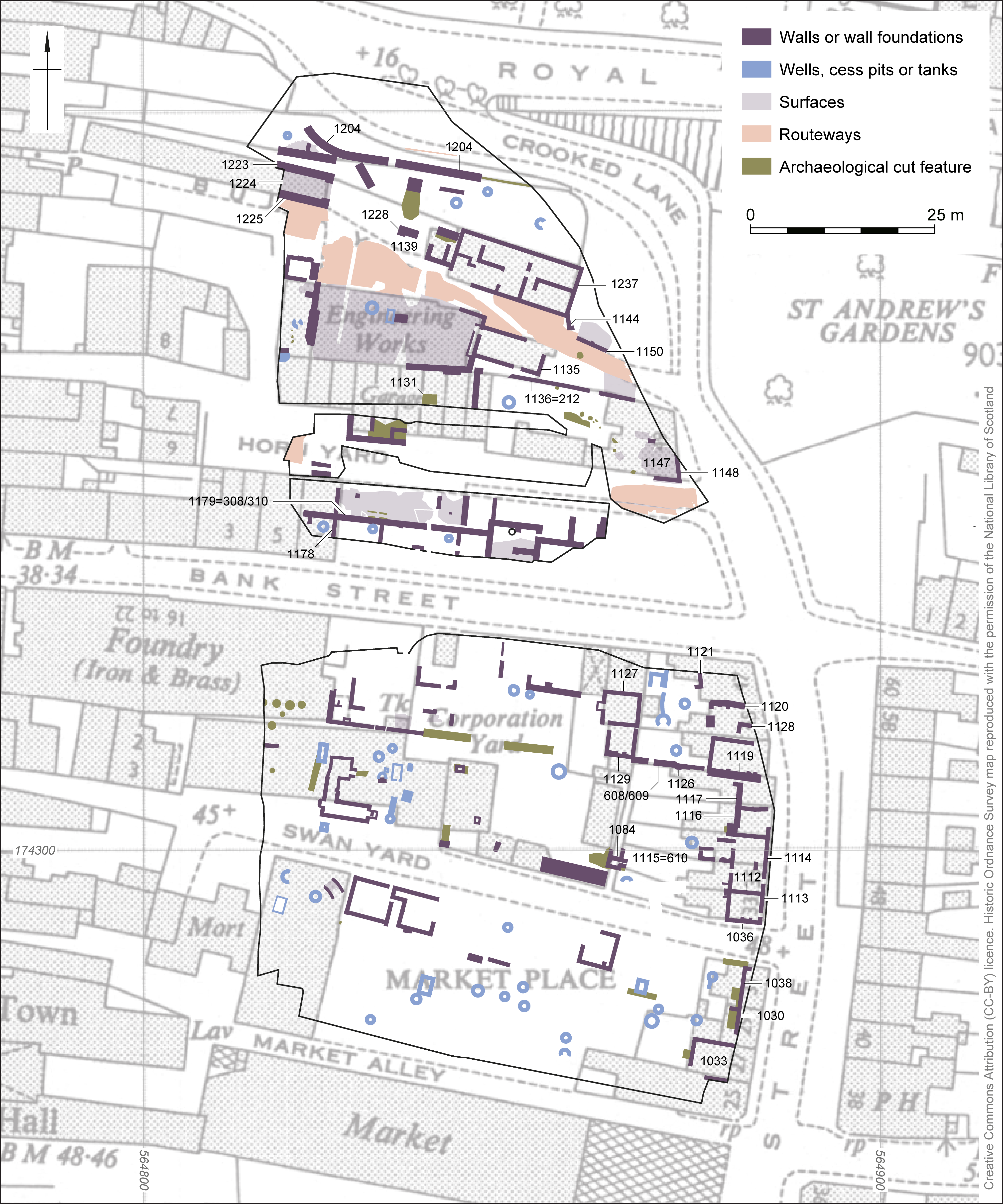
Nineteenth-century remains in Gravesend (Kent, UK) were revealed by excavation, chiefly comprising buildings, along with wells and cesspits. Historic maps, newspaper archives and other sources have been used to interpret the majority of the site as a low status 'slum' accessed from narrow pedestrian passageways (Bull Yard, Horn Yard, Swan Yard and Market Alley). These areas comprised a poorly planned mixture of dwellings and premises including slaughterhouses, piggeries, warehouses and other commercial and small-scale industrial properties. A newspaper account described a view of the interiors of dwellings glimpsed through broken windows on Market Alley as 'A state of things which ought not to be permitted' (Gravesend and Dartford Reporter, 12 July 1879). Some parts of the site (Bank Street and Queen Street) were occupied by higher status dwellings and premises, including a medium-sized coach factory.
Corresponding author: Ashley Tuck
[email protected]
Wessex Archaeology
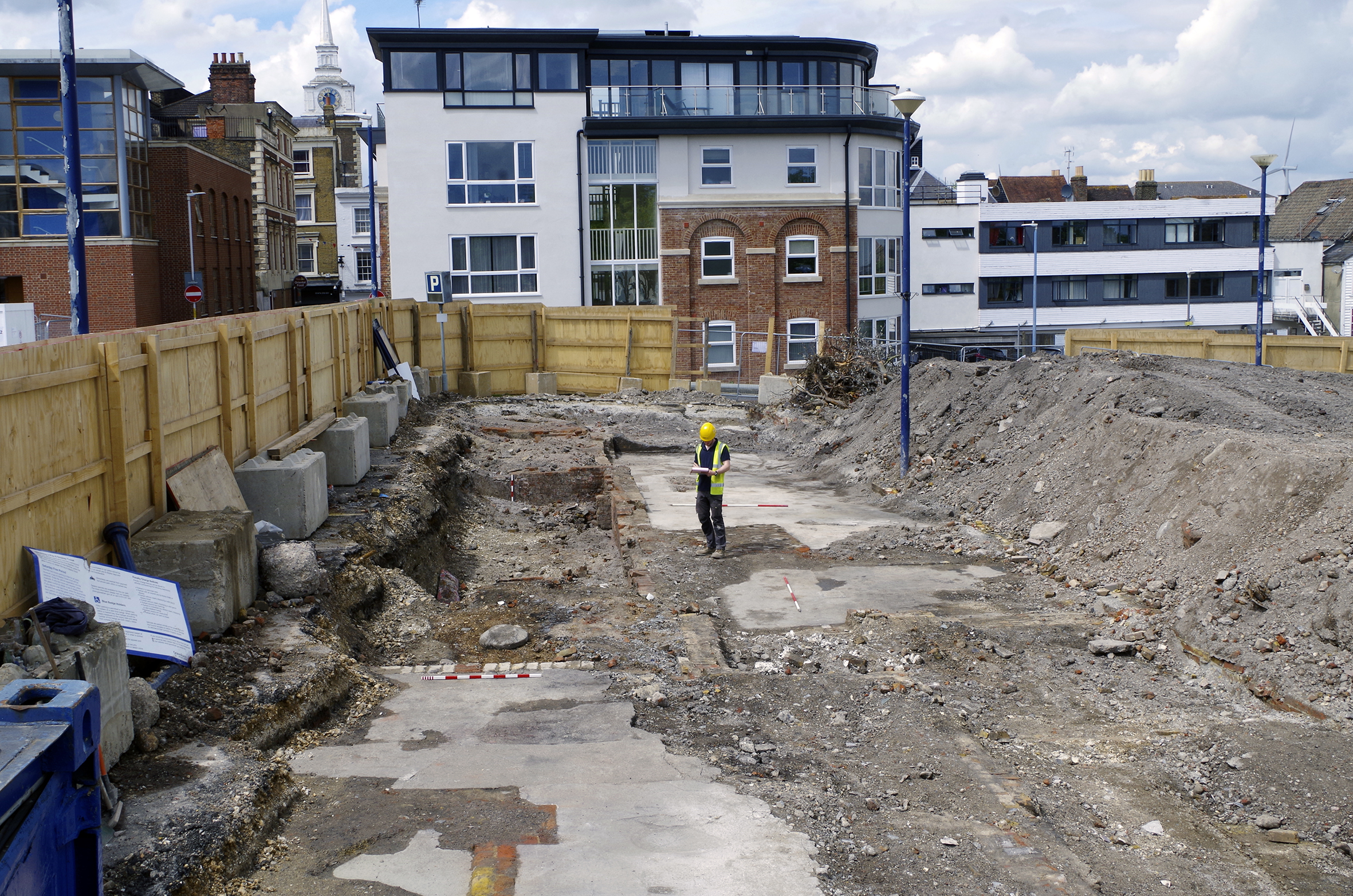
Figure 1: Site location
Figure 1b: Excavation results compared to 1866 Ordnance Survey town plan (interactive map)
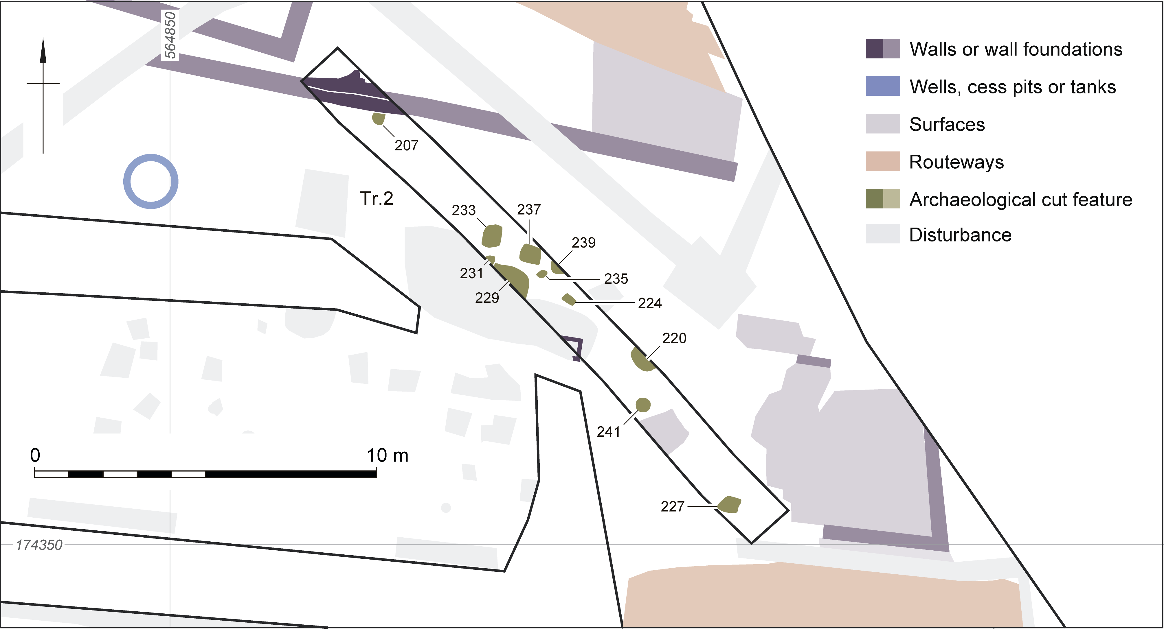
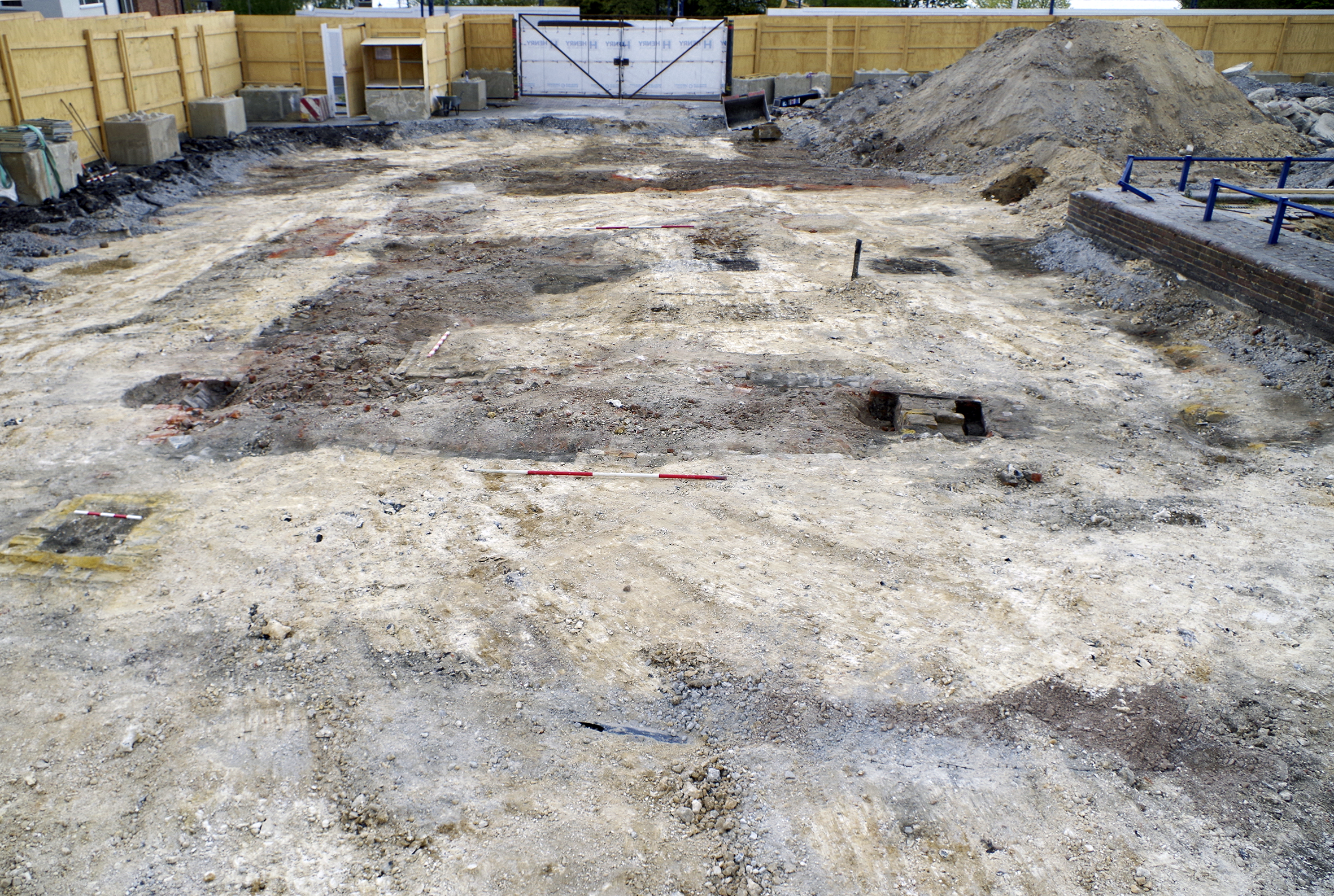
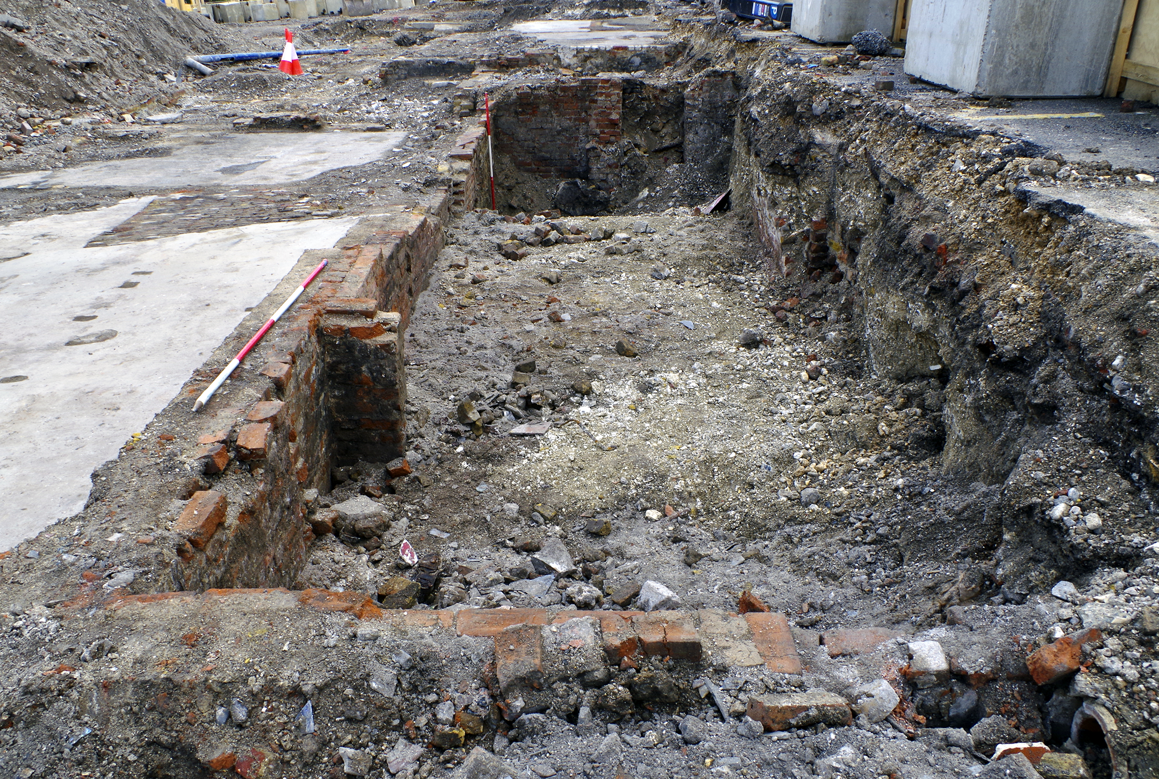
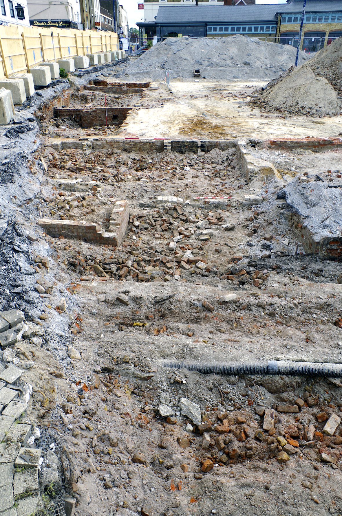
Figure 2: Plan of discrete features in Trench 2
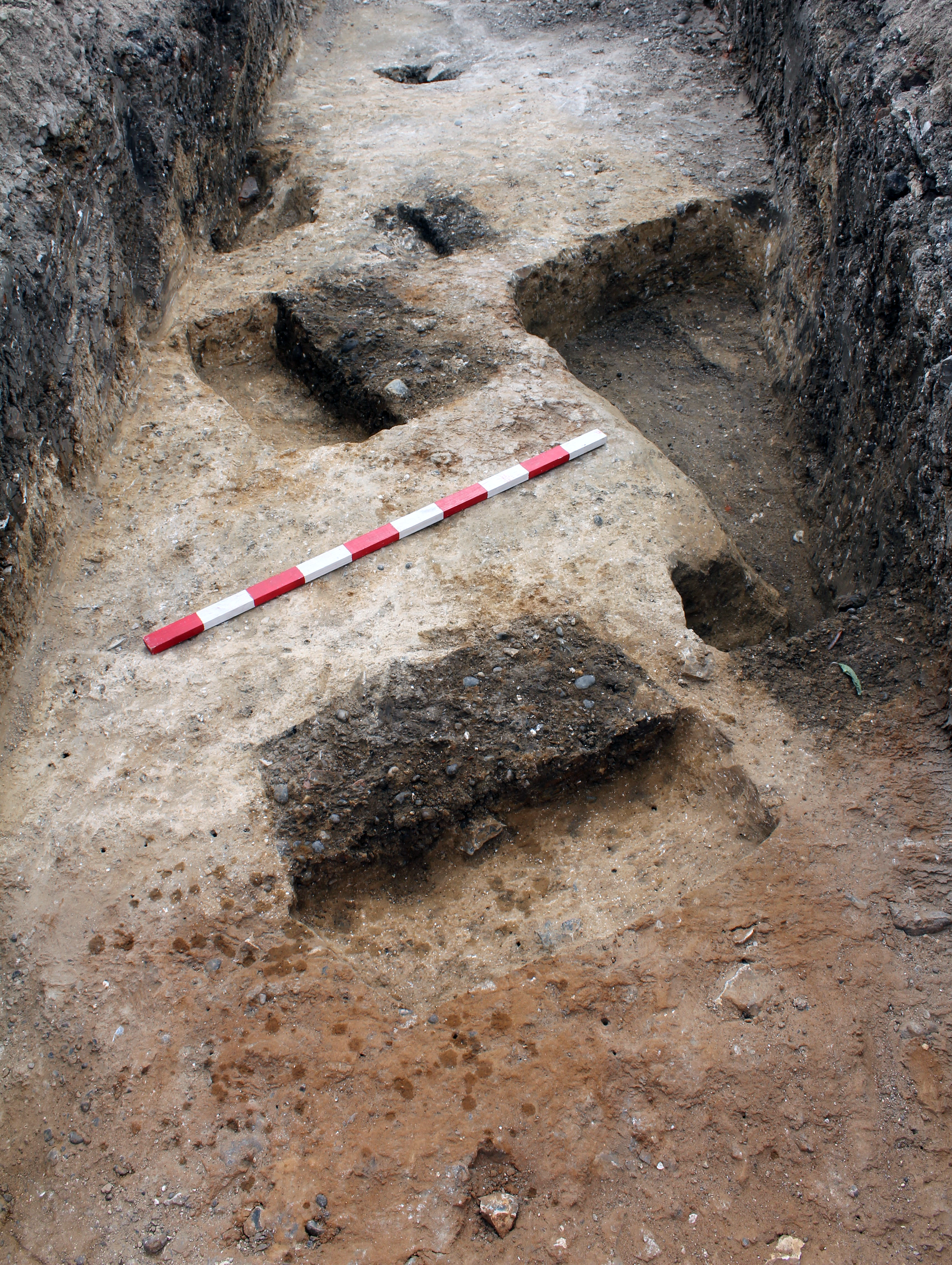
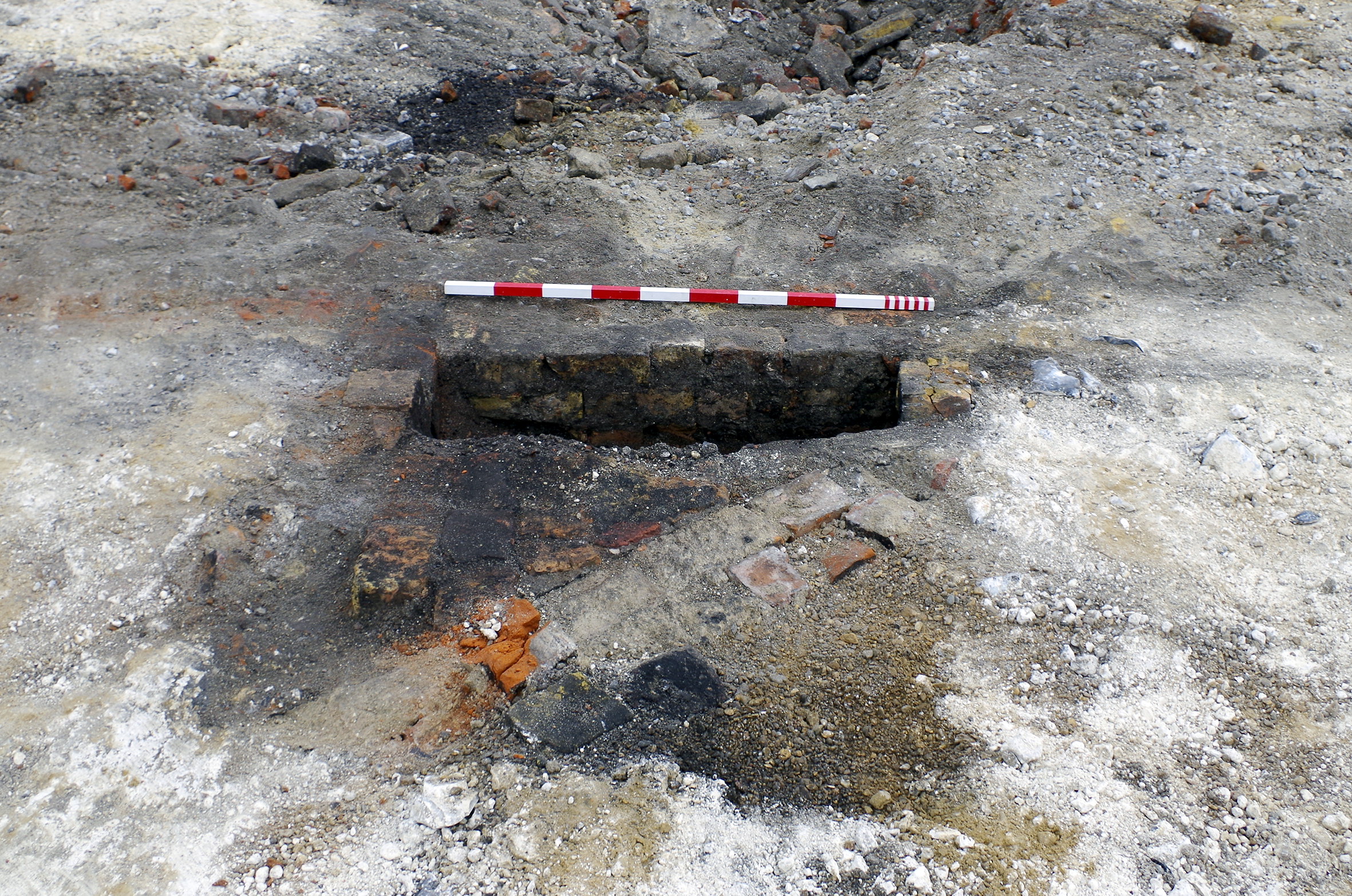
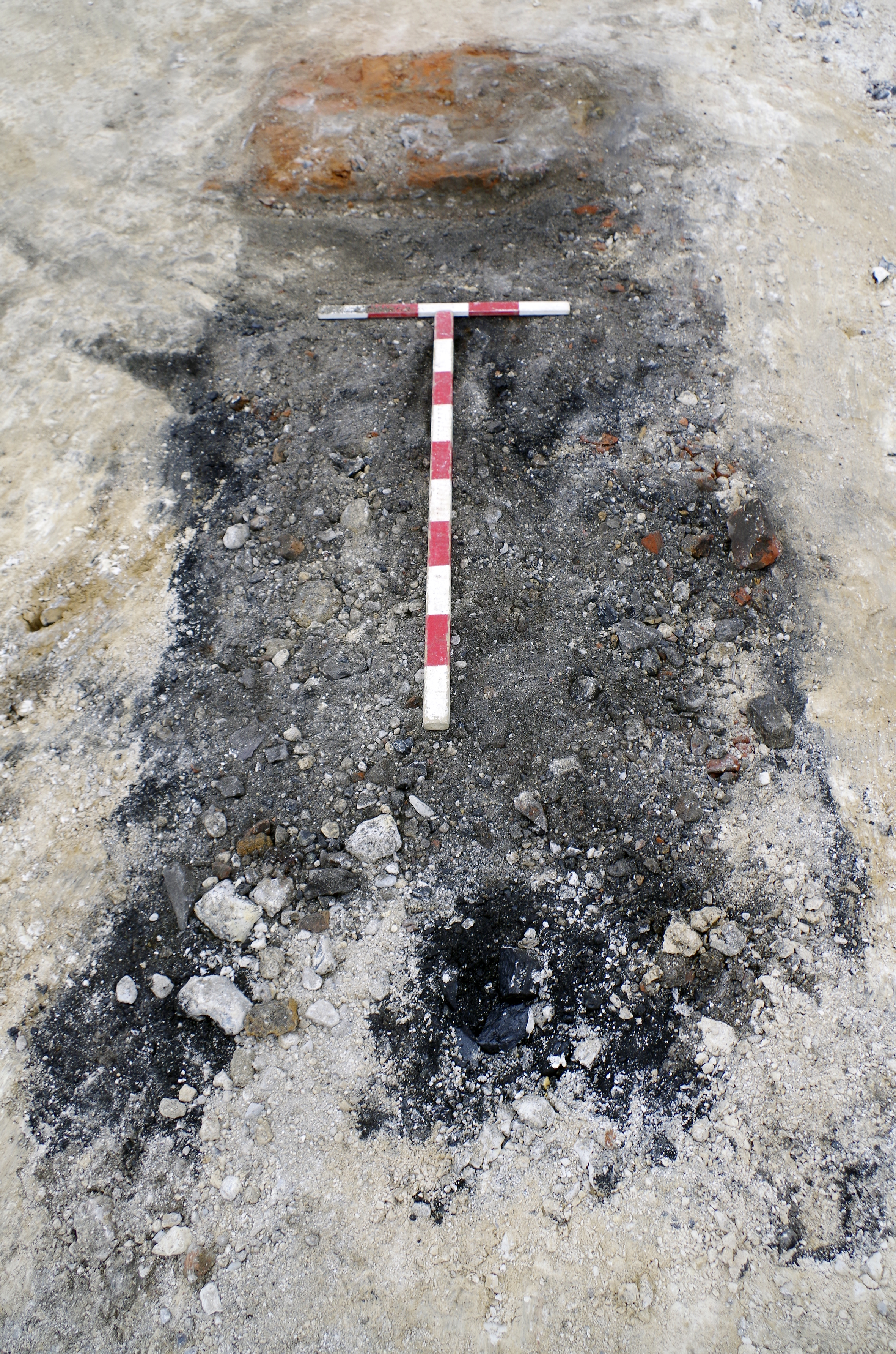
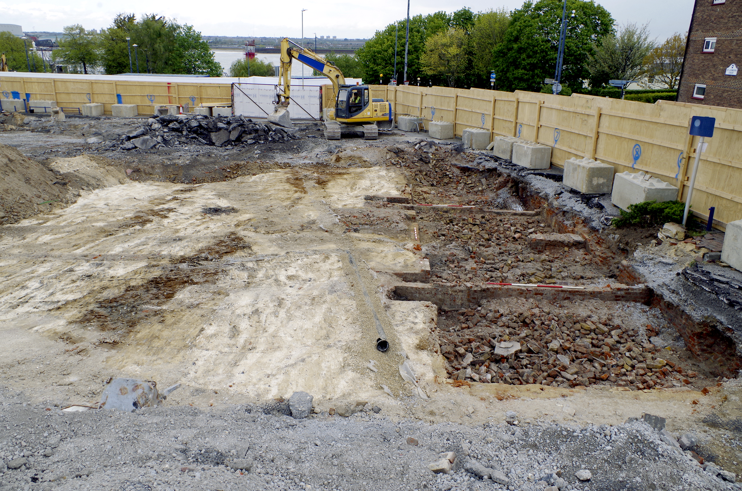
Figure 3: Group shot of pits 229 and 237 and postholes 231 and 235. 1 x 1m scale. View from south-east
Figure 4: Excavation results overlaid on 1840 tithe map
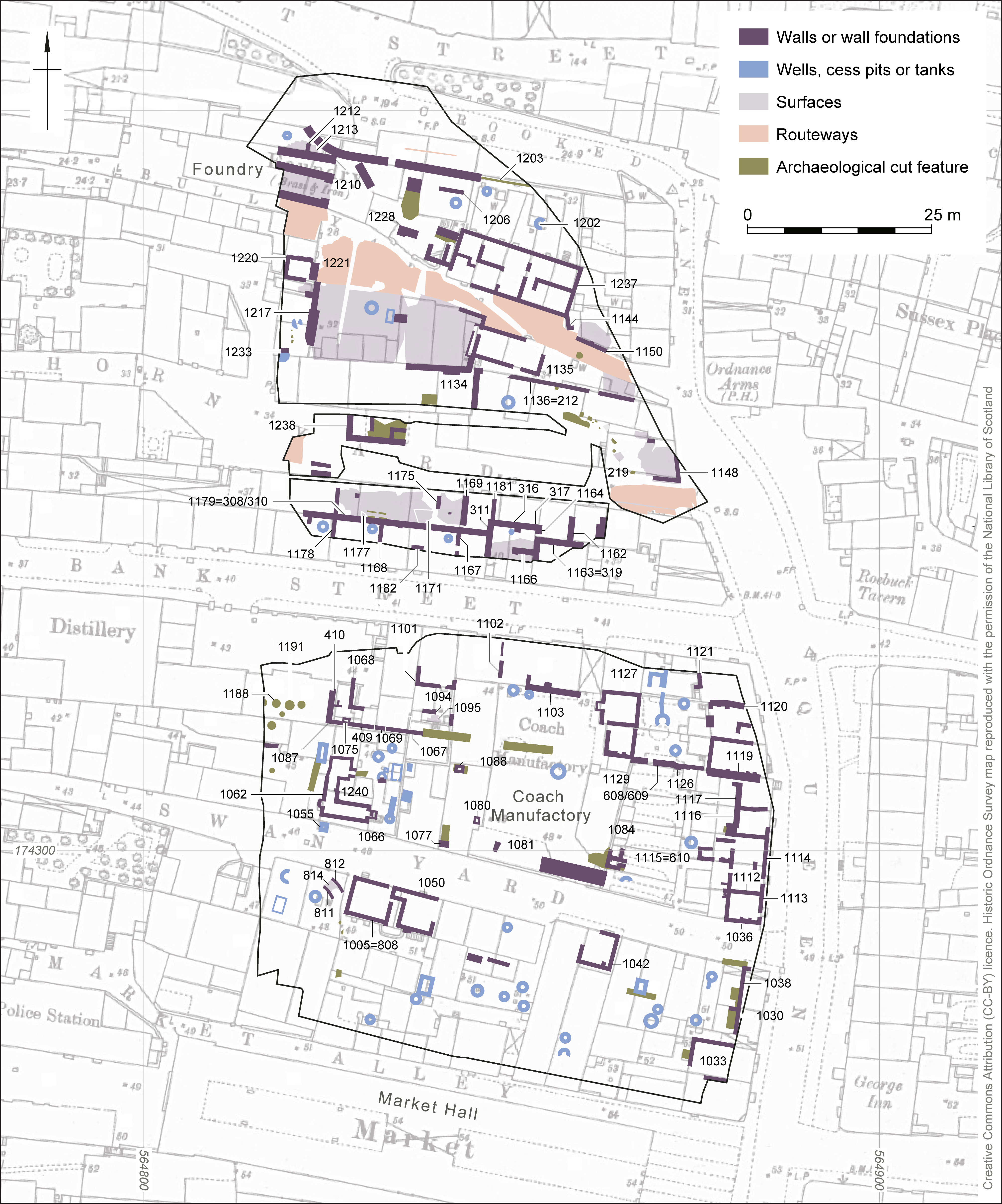
Figure 5: Excavation results overlaid on 1866 Ordnance Survey town plan
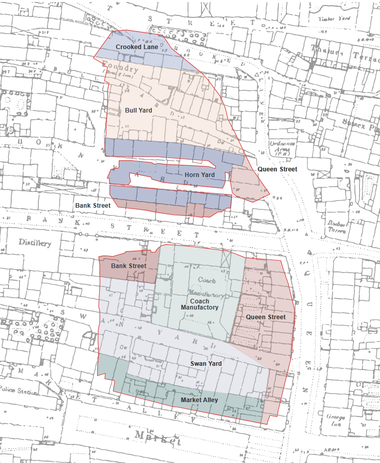
Figure 6: Clickable map of thoroughfares within the site
Figure 7: Extract from the Gravesend and Dartford Reporter, 12 July 1879. The British Newspaper Archive is © The British Library Board, reproduced by kind permission.
Figure 8: Excavation results overlaid on 1909 Ordnance Survey map
Figure 9: Excavation results overlaid on 1932 Ordnance Survey map
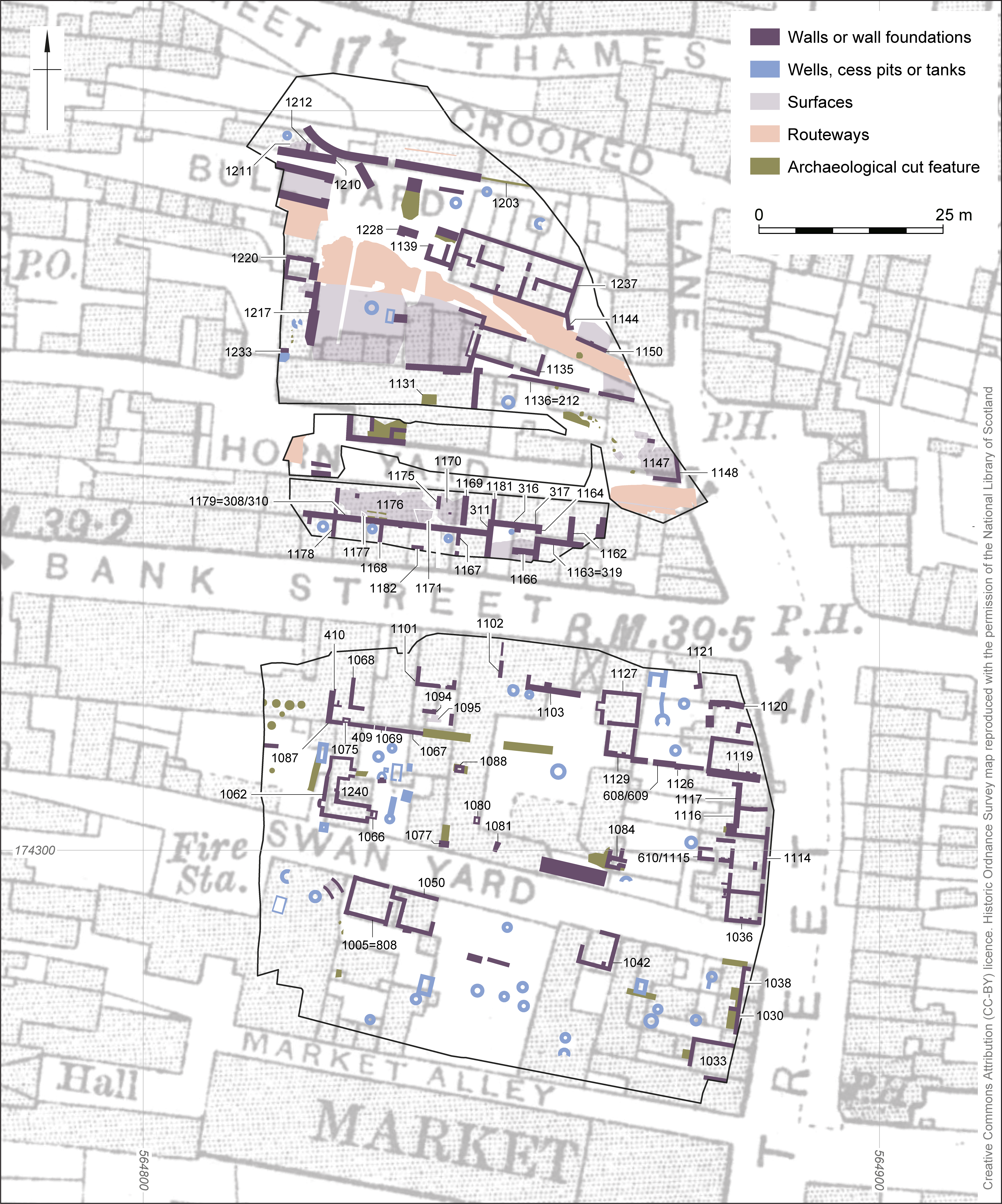
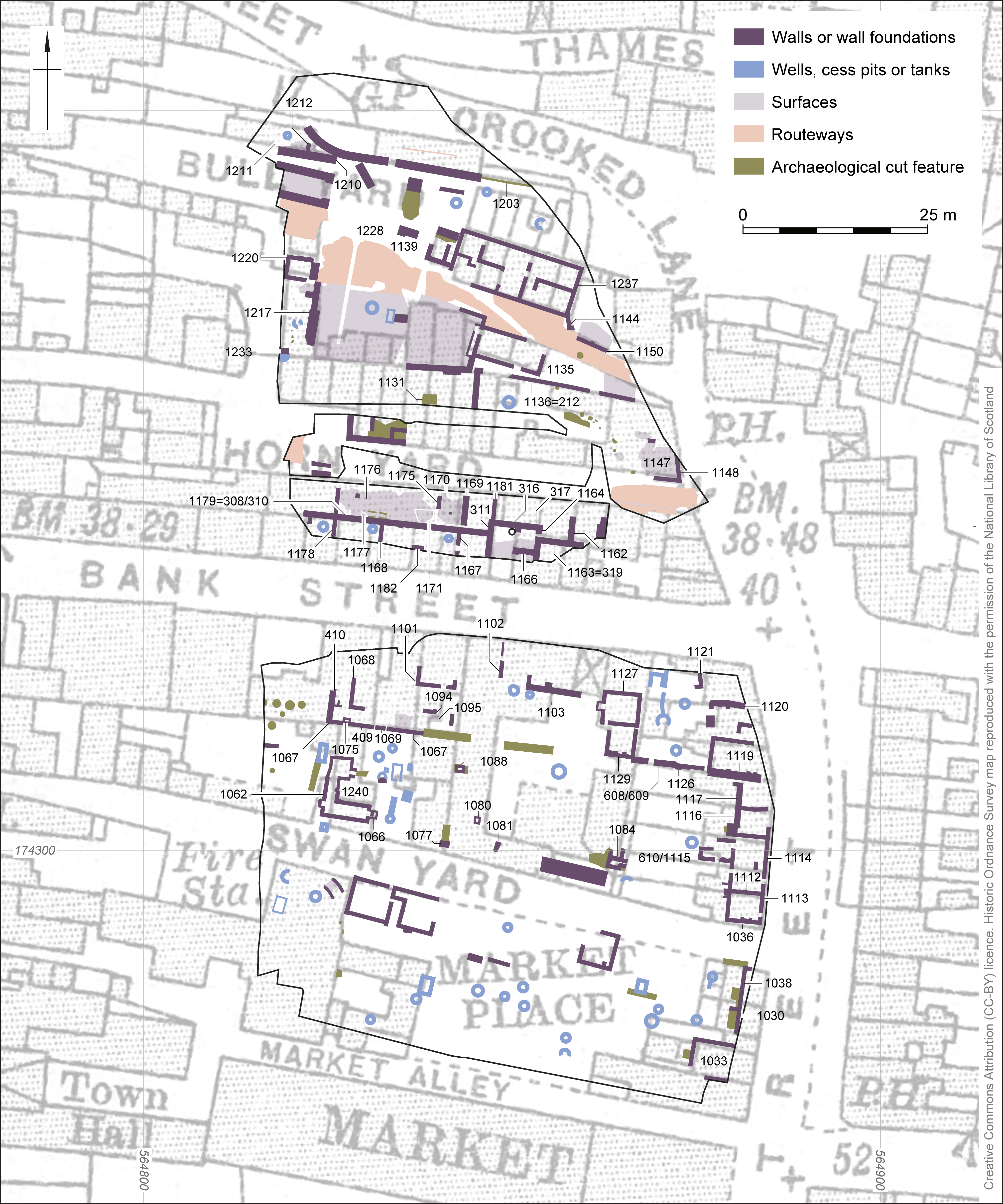
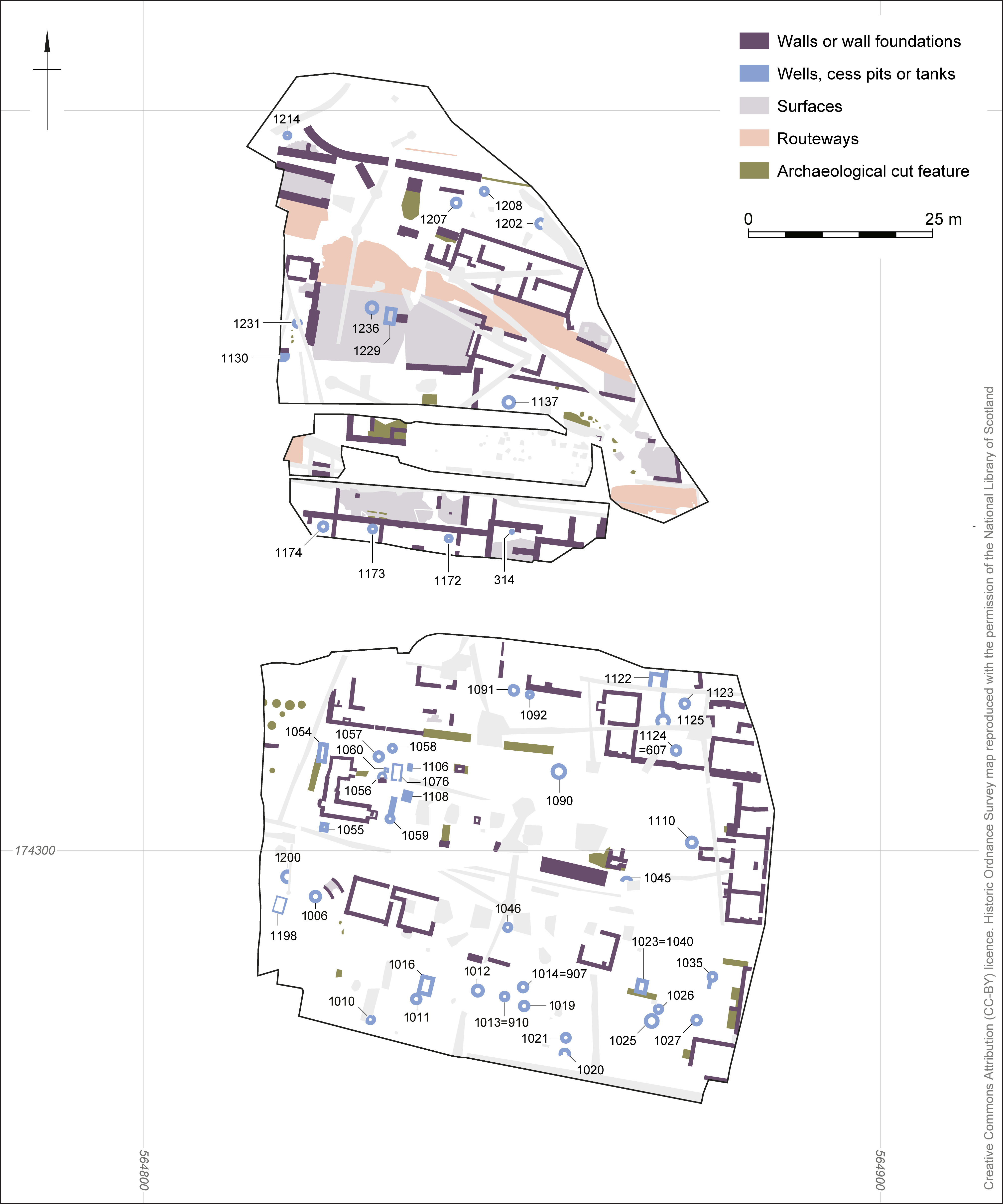
Figure 10: Plan of cesspits, wells and tanks
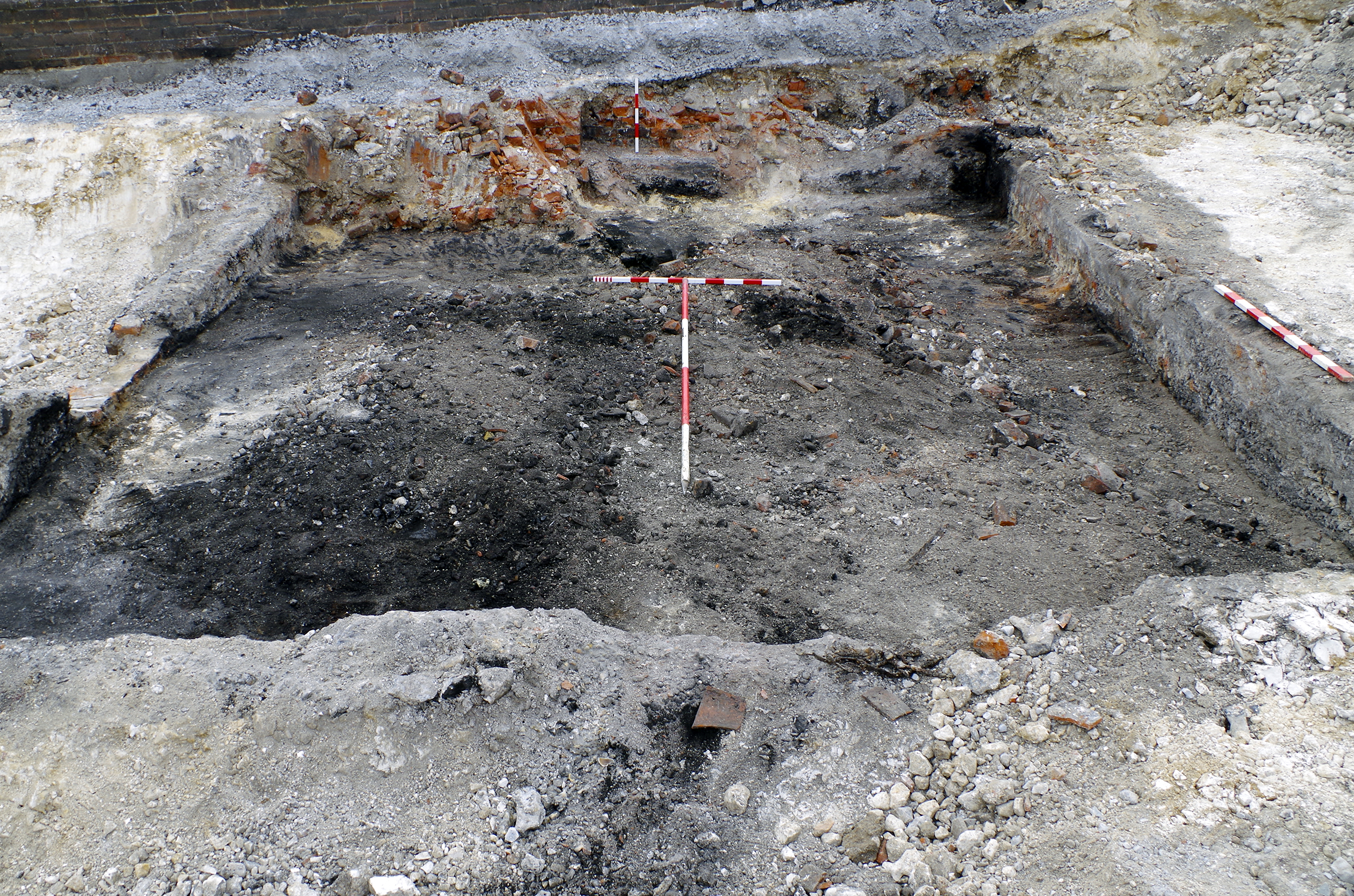
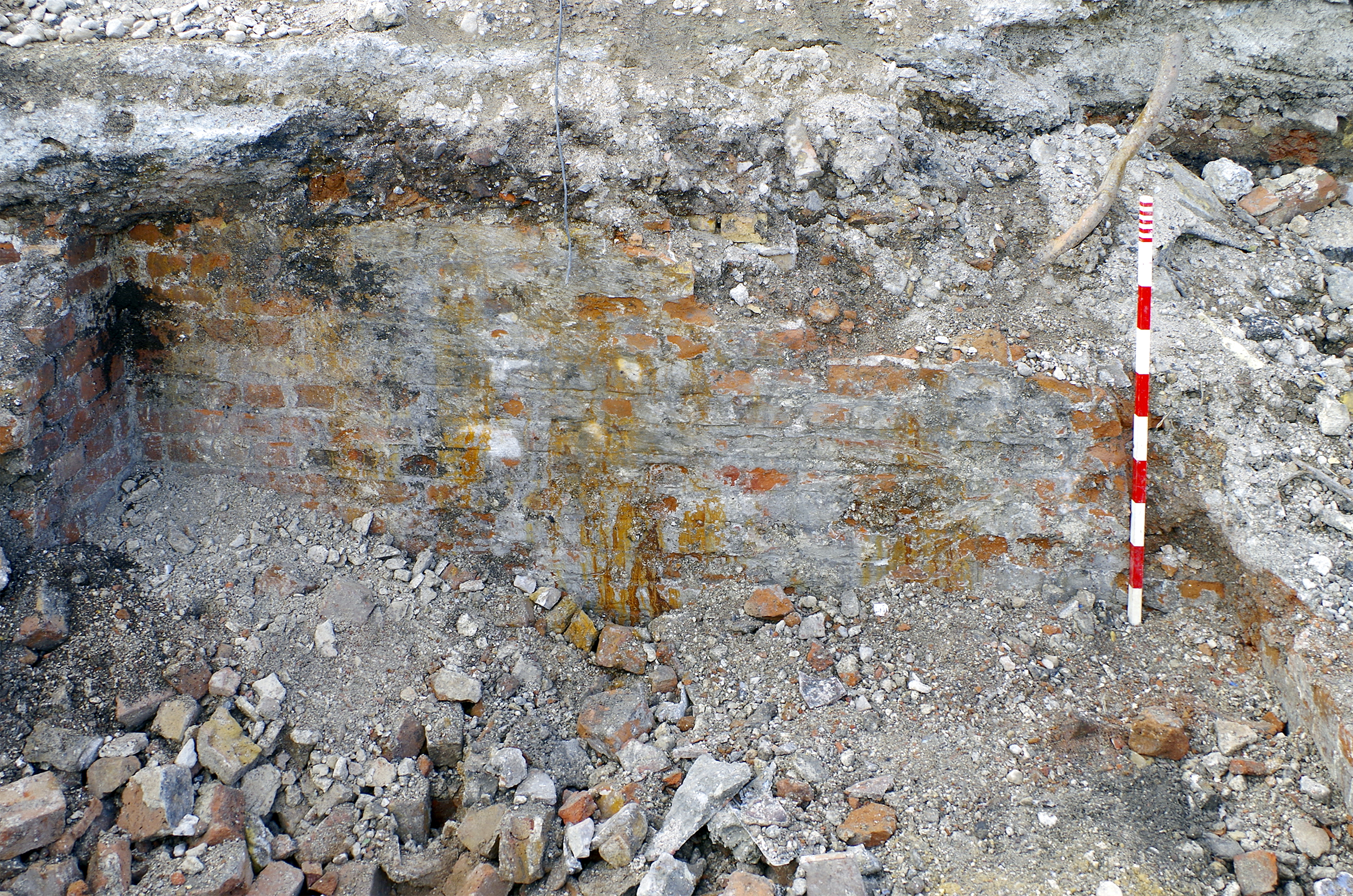
Figure 11: Cesspit 1027. 1 x 1m scale. View from south
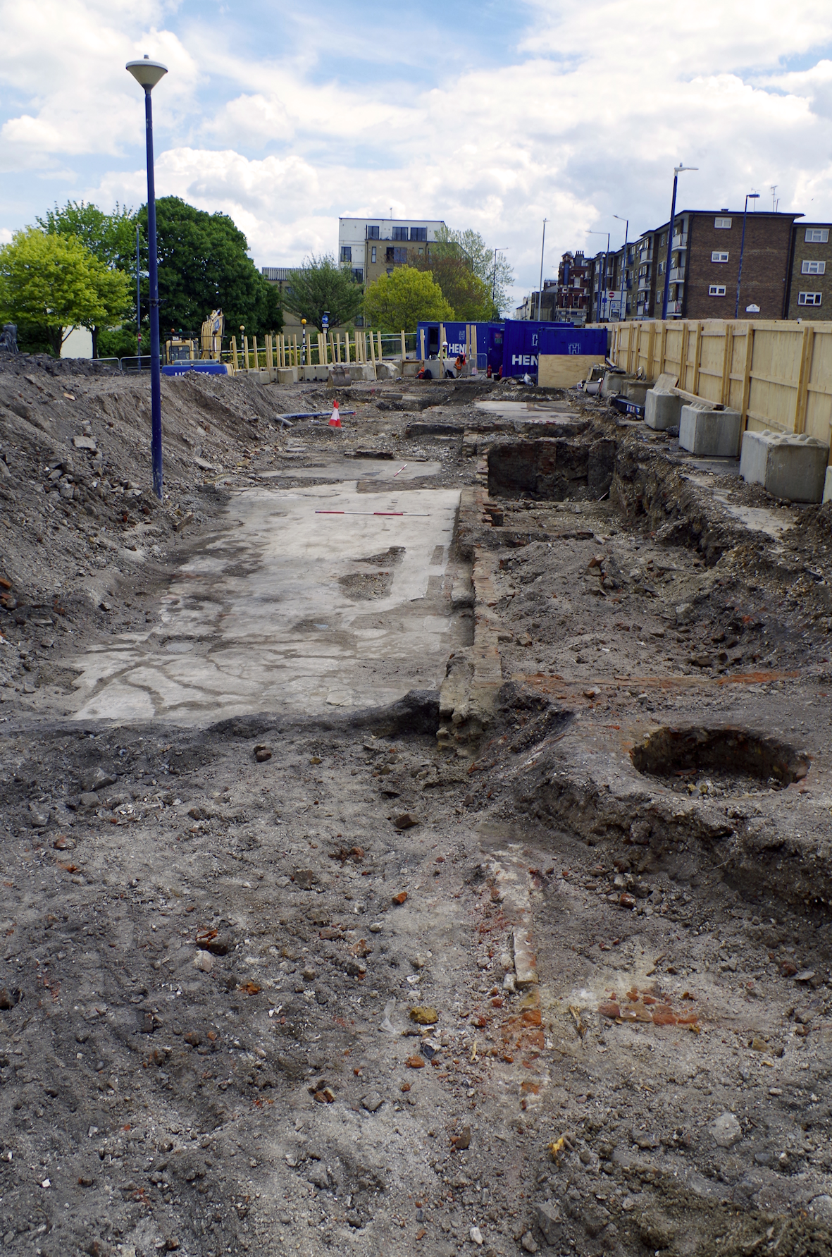
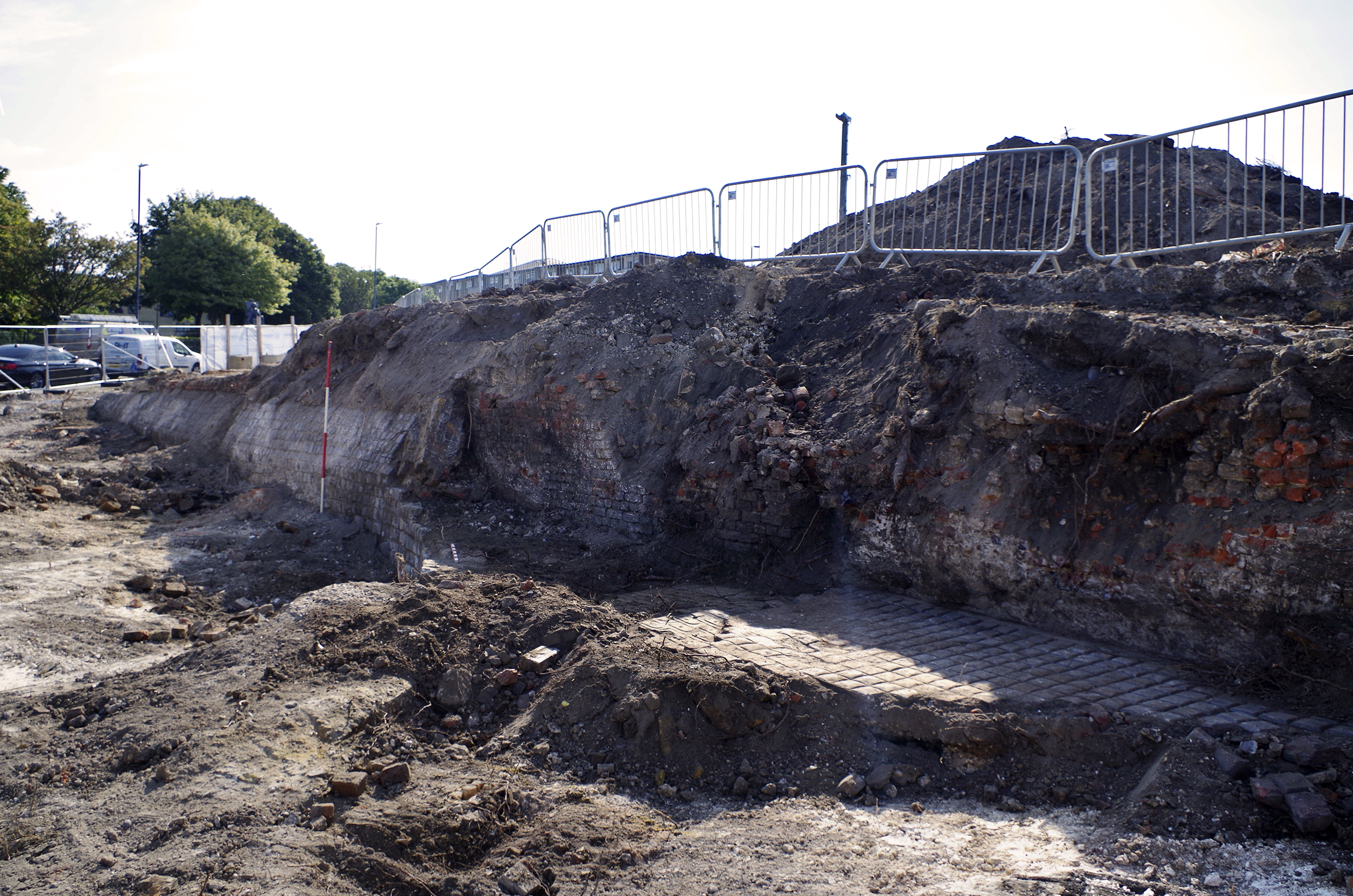
Figure 12: Cellars north of Bank Street (1178, 1179=308, 1168 etc.) with well 1174 in foreground. View from west
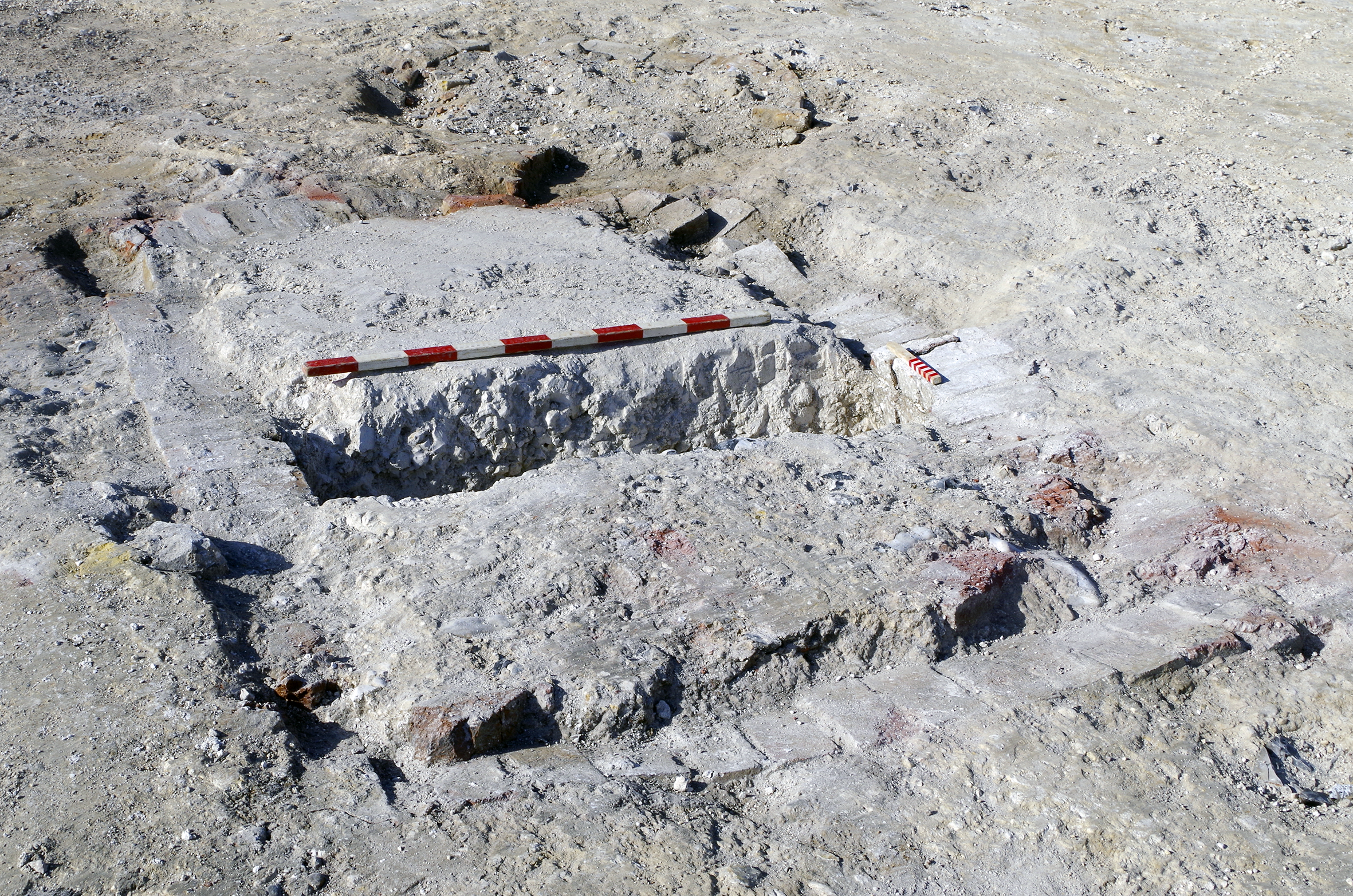
Figure 13: Tank 1016. 1 x 1m scale. View from north-east
Figure 14: Cellar 1005=808 showing unusual concrete lining. 1 x 0.8m scale, 2 x 1m scales and 1 x 2m scale. View from east
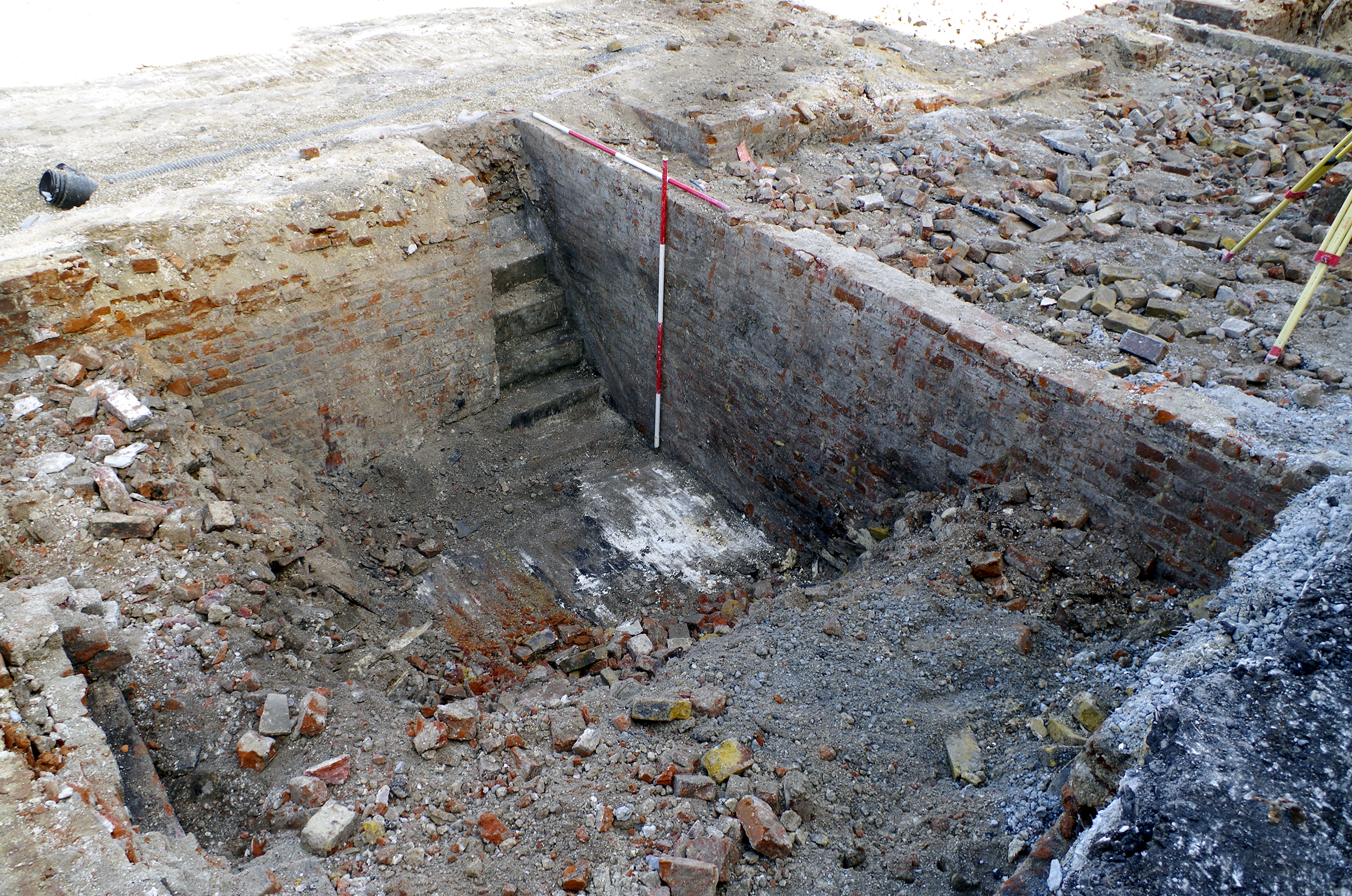
Figure 15: Staircase accessing cellar 1050 with treads removed. 1 x 1m scale. View from south
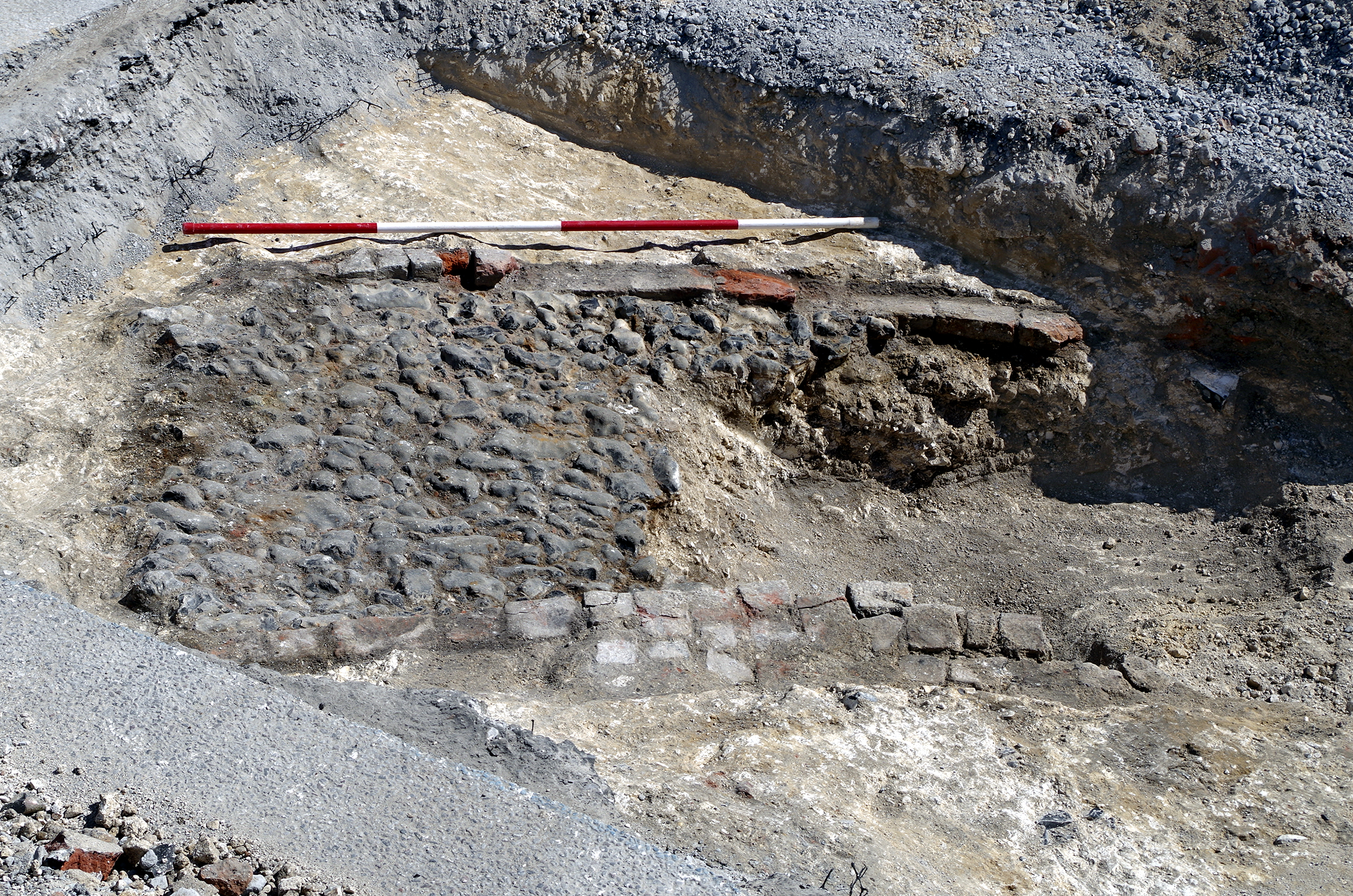
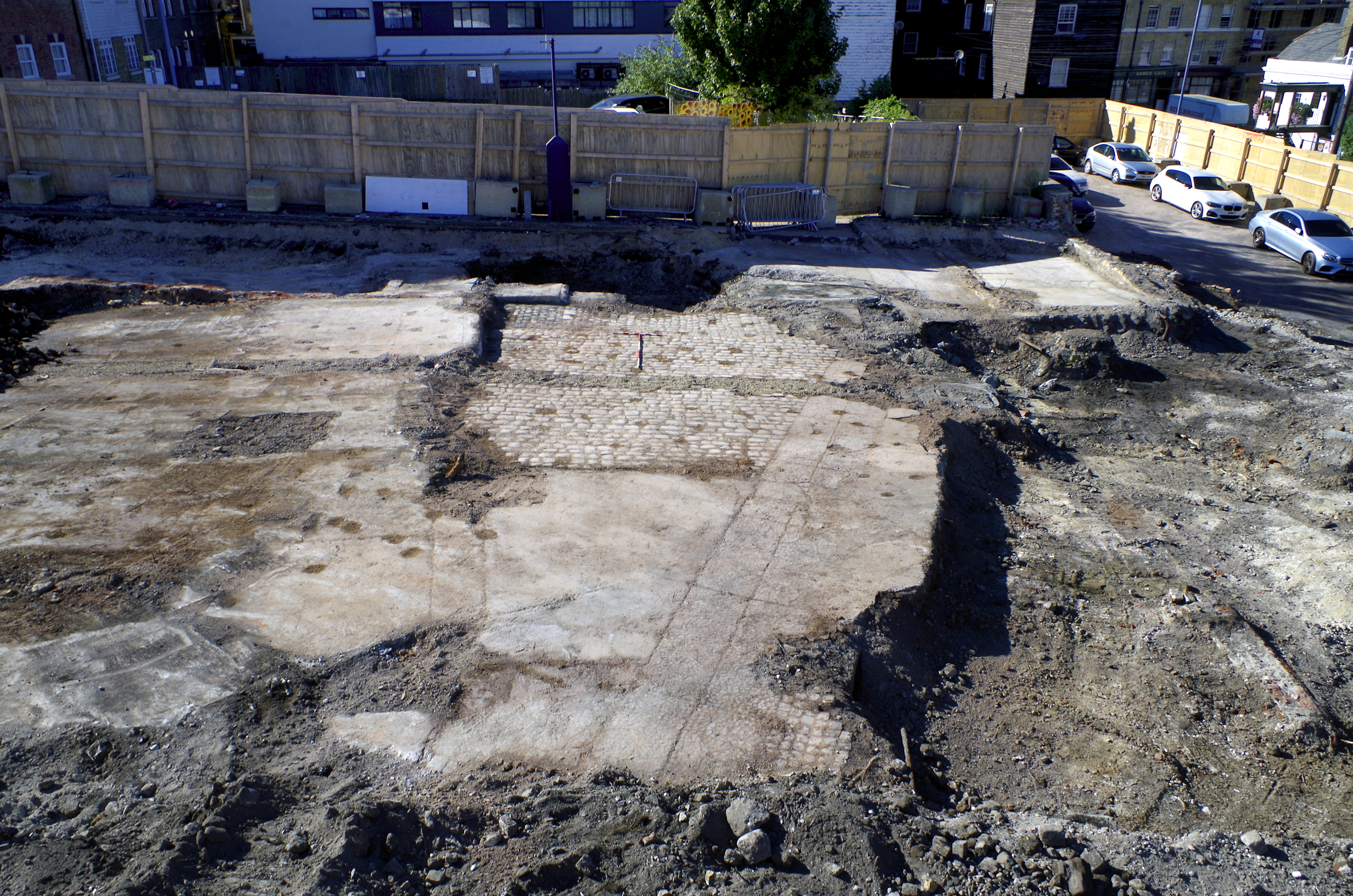
Figure 16: Cobble surface 814 surrounded by walls 811 and 812. 1 x 2m scale. View from west
Figure 17: Cellar 1042. 1 x 1m scale, 1 x 2m scale. View from west
Figure 18: Cellar 1240. 2 x 1m scales, 2 x 2m scales. View from south
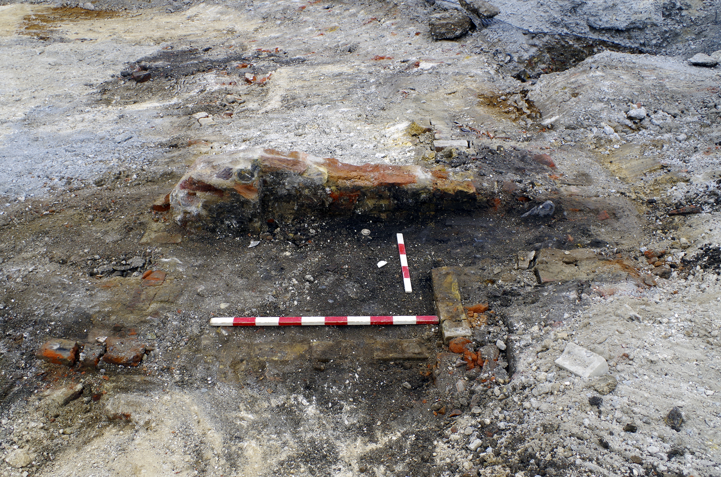
Figure 19: Coal chute, part of 1062. 1 x 1m scale. View from north
Figure 20: Staircase 1066. 1 x 1m scale, 1 x 2m scale. View from east
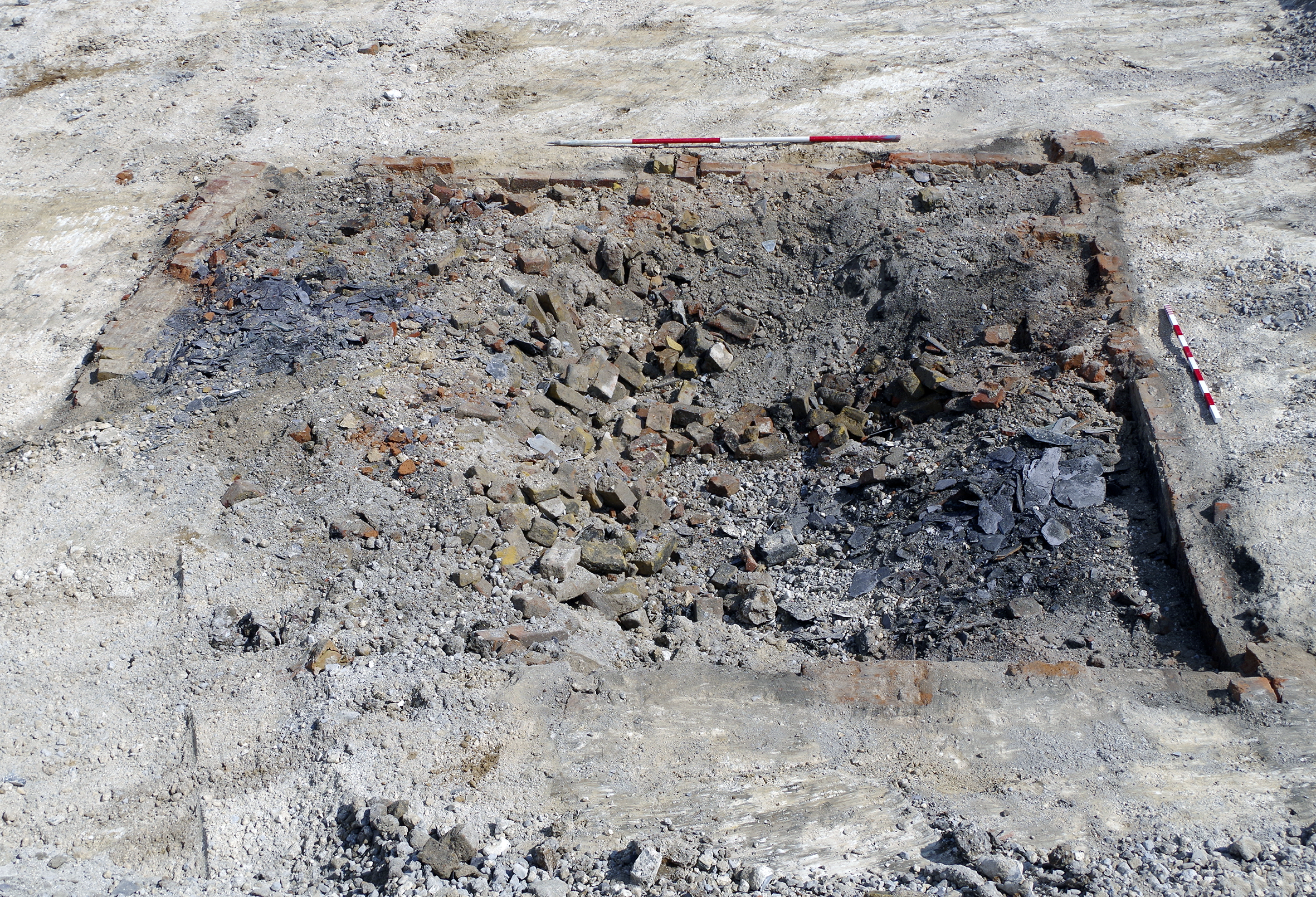
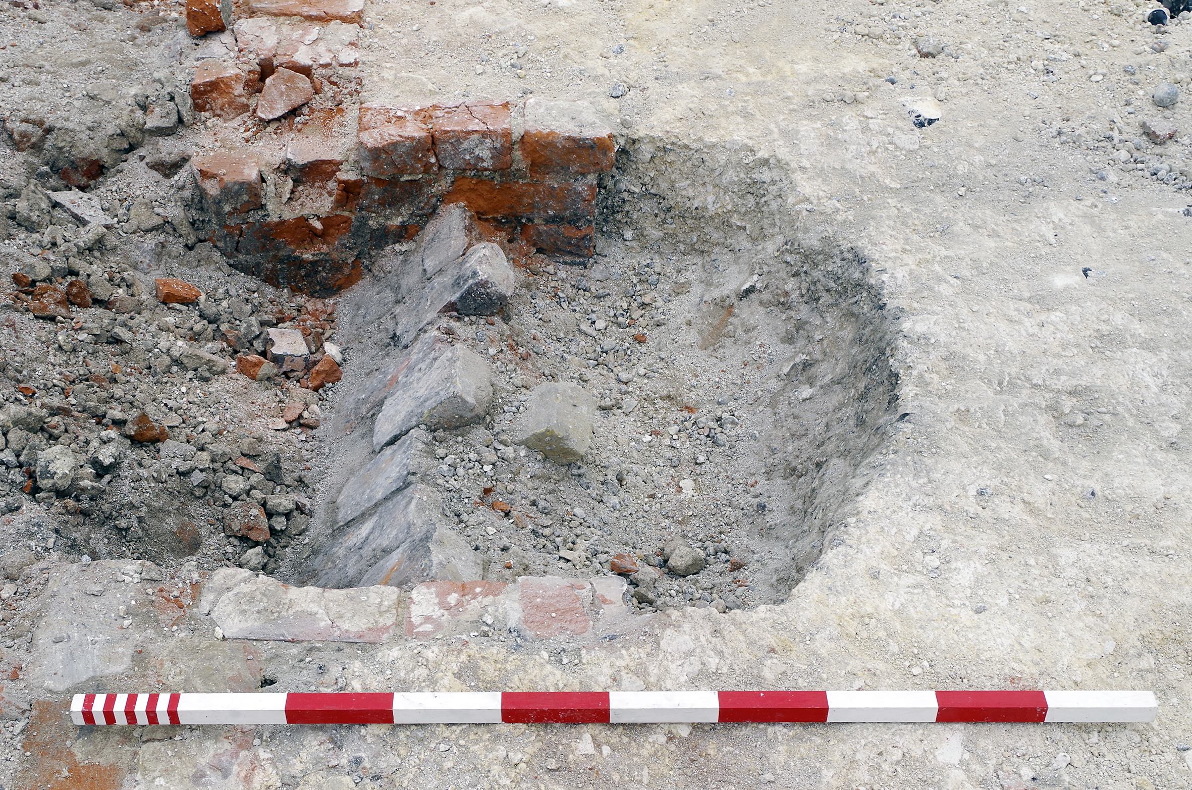
Figure 21: Pit 1188 and associated brick-lined structure. 1 x 1m scale. View from north
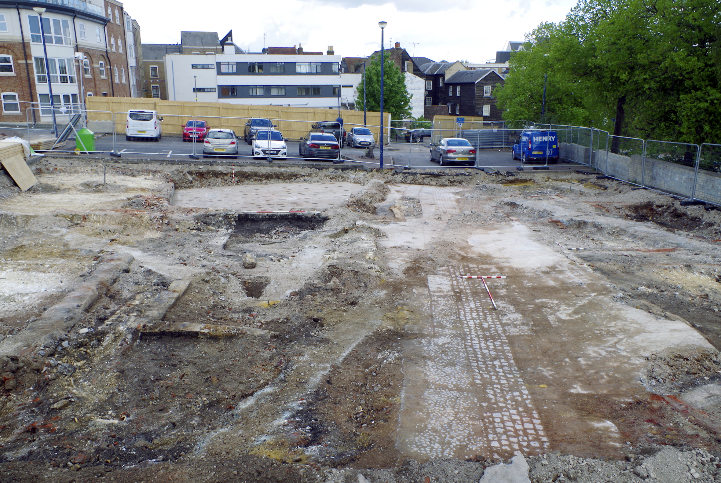
Figure 22: Excavation results overlaid on 1955 Ordnance Survey map
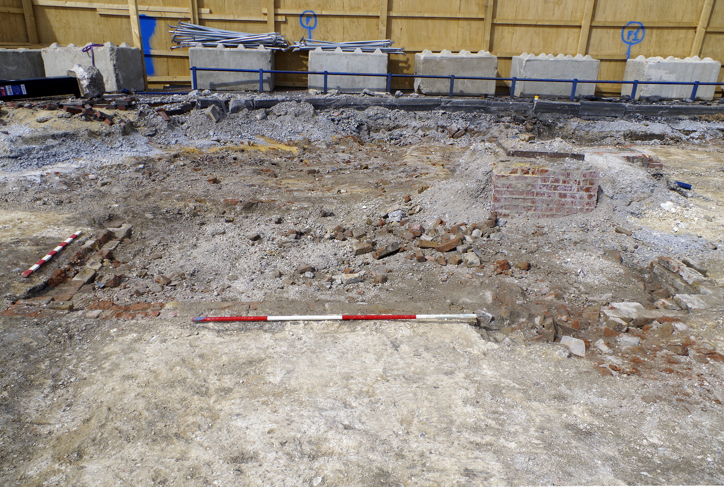
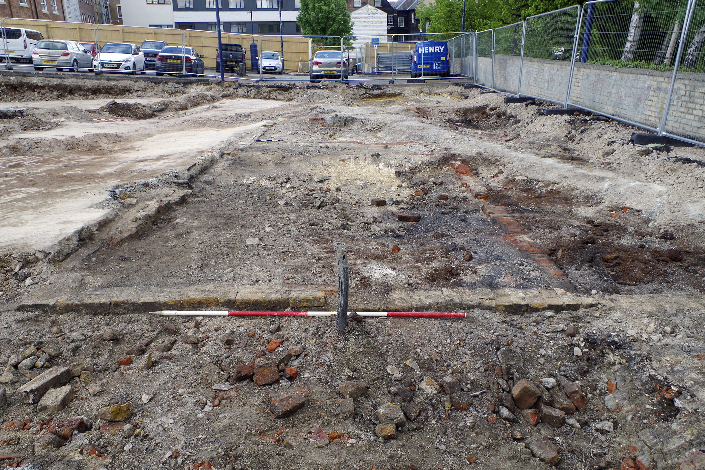
Figure 23: Working shot. In left of shot, cellars fronting Bank Street (1167, 1168, 1178, 1179=308 and 1182) with yard surface 1165 and wall 1166 in foreground. In right of shot, yard surfaces (1171, 1176 etc.) with house foundations 1169 and 1181 in foreground. 1 x 0.5m scale, 2 x 1m scales, 1 x 2m scale. View from east
Figure 24: Figure 24: Cellar 1167 and 1168 partially excavated. 2 x 2m scales. View from west
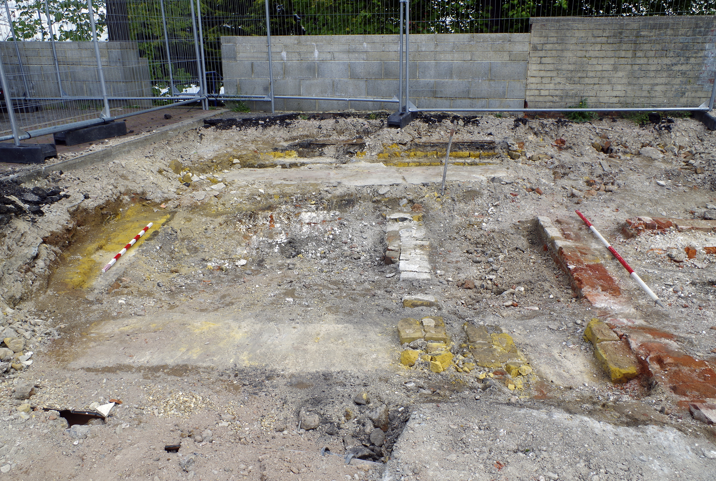
Figure 25: Coach works front range 1102 and 1103 (also cesspit/well 1092). 1 x 1m scale, 1 x 2m scale. View from east
Figure 26: Coach works east range cellars 1127 and 1129 (in foreground). View from north-east
Figure 27: Machine base 1077 within larger construction cut 1078. 1 x 0.5m scale, 1 x 1m scale. View from north
Figure 28: Cellar 1101 (8 Bank Street). 1 x 1m scale, 1 x 2m scale. View from south
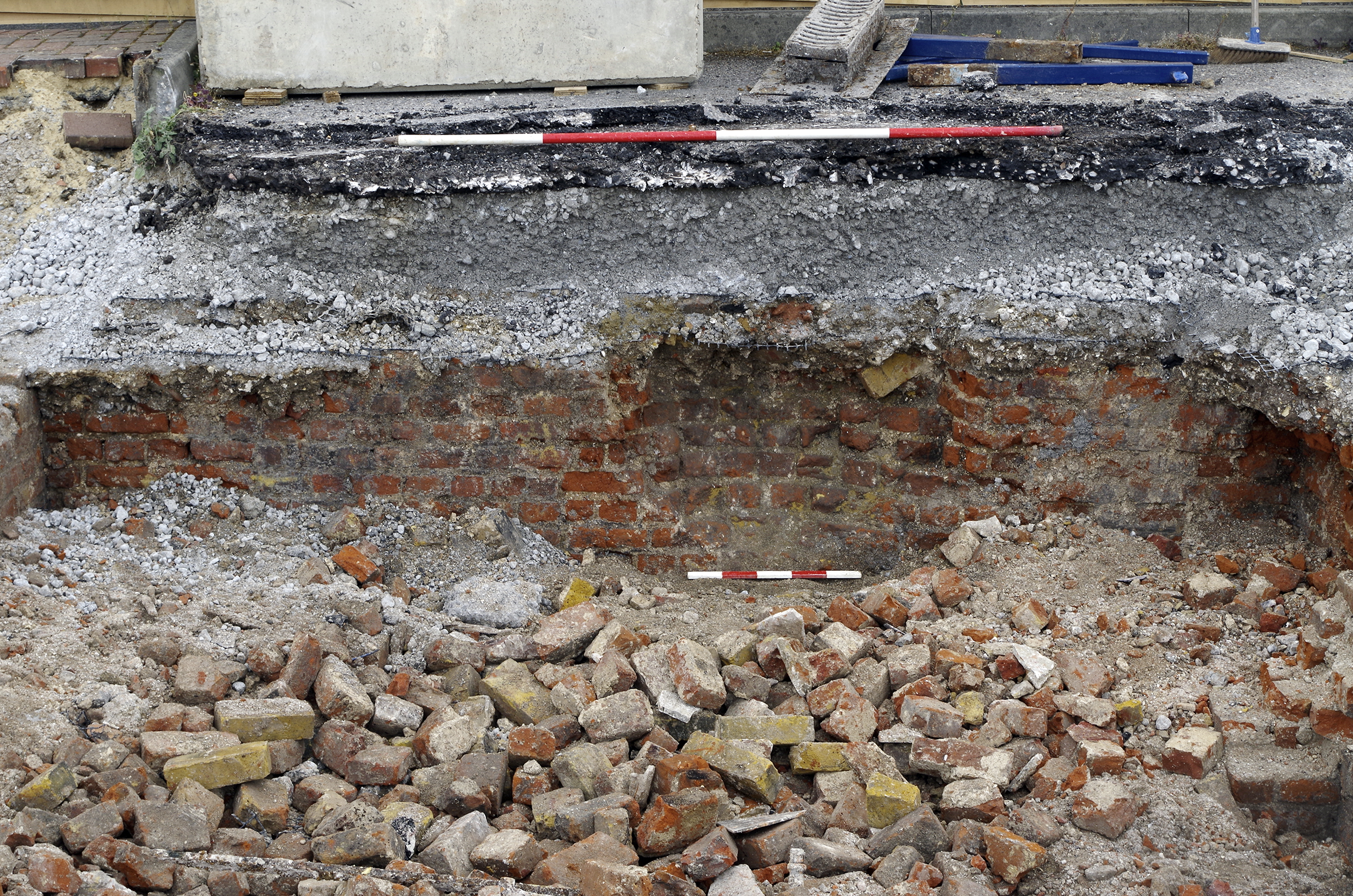
Figure 29: Wall 1094 at rear of 8 Bank Street. 1 x 1m scale. View from north
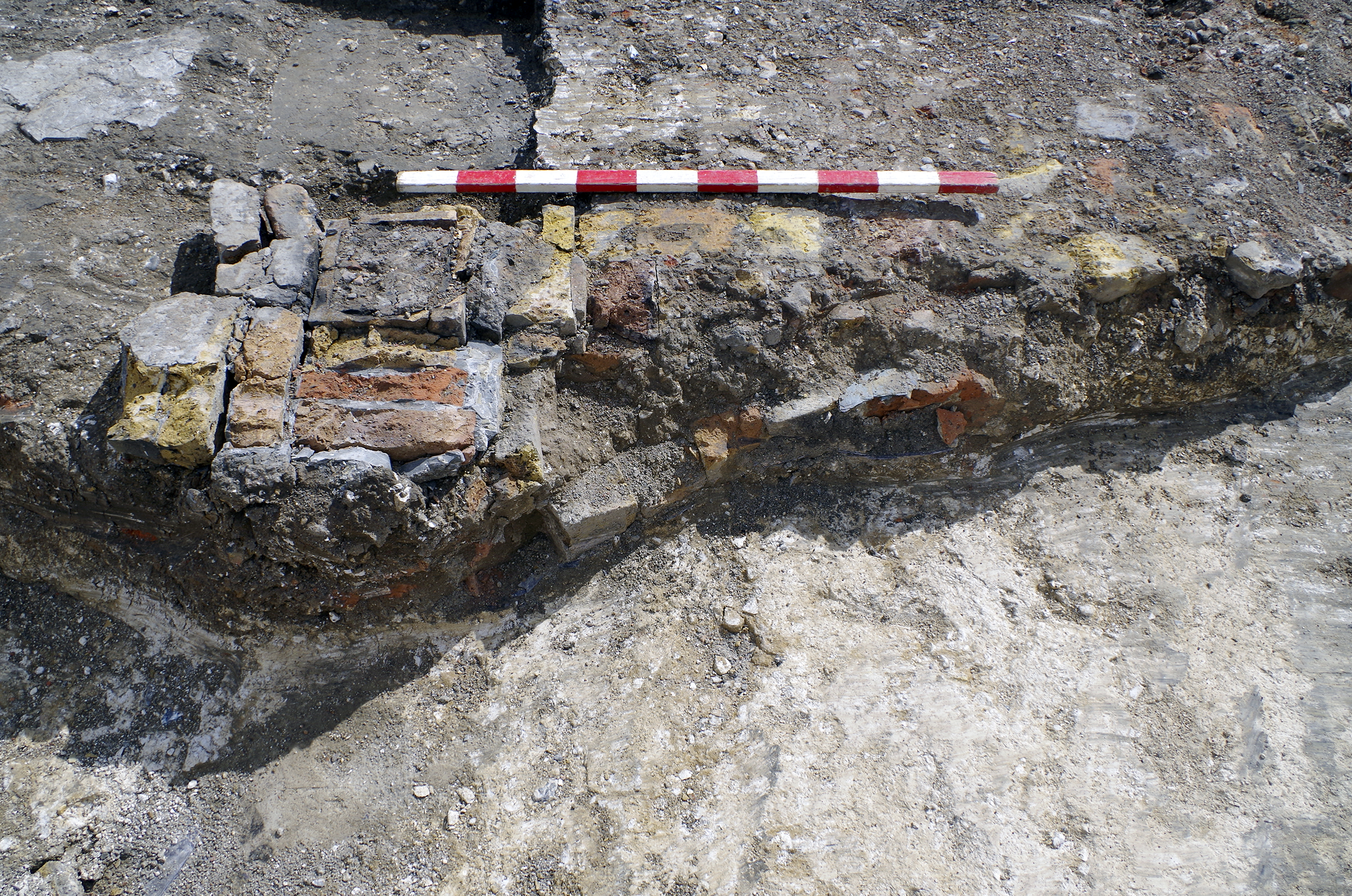
Figure 30: Foundation 1238. 1 x 1m scale, 1 x 2m scale. View from north
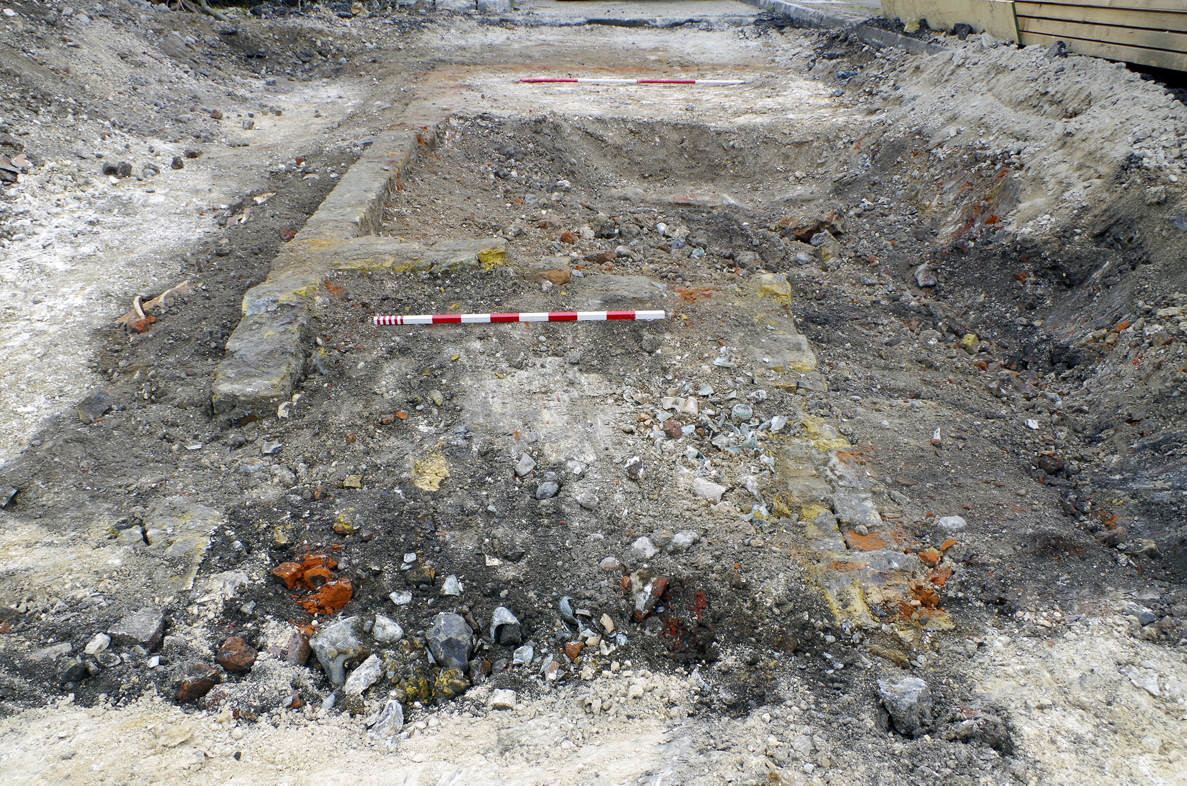
Figure 31: Cellar 1220 on Bull Yard square. 1 x 1m scale. View from east
Figure 32: Cellars 1135 and 1148 (centre left of shot) with 20th-century surface of Bull Yard (centre right). 2 x 0.5m scales, 2 x 1m scales, 2 x 2m scales. View from east
Figure 33: Cellars 1237 of terrace north of Bull Yard. 2 x 0.5m scales, 1 x 2m scale. View from east
Figure 34: Extension 1139 (yellow brick) with main terrace 1140 (red brick) on right. 1 x 1m scale, 1 x 2m scale. View from south
Figure 35: Surfaces of Bull Yard, including cobblestones 1221 (centre). 1 x 1m scale, 1 x 2m scale. View from east
Figure 36: Red brick wall 1203/1210 replaced by unusual granite sett and Portland cement wall 1204. 1 x 0.5m scale, 1 x 2m scale. View from north-west
Figure 37: Yellow brick surface 1213, red brick wall 1210 and later textured concrete surface 1211. 1 x 1m scale. View from east
Figure 38: Cellar 1033 on Queen Street. 1 x 1m scale and 1 x 2m scale. View from south-east
Figure 39: Cellars 1036=1112 and 1113-1117 fronting Queen Street. 1 x 1m scale, 2 x 2m scales. View from south
Figure 40: Cellar 1112 excavated to floor, showing concrete repair to stairs. 2 x 2m scales. View from south-east
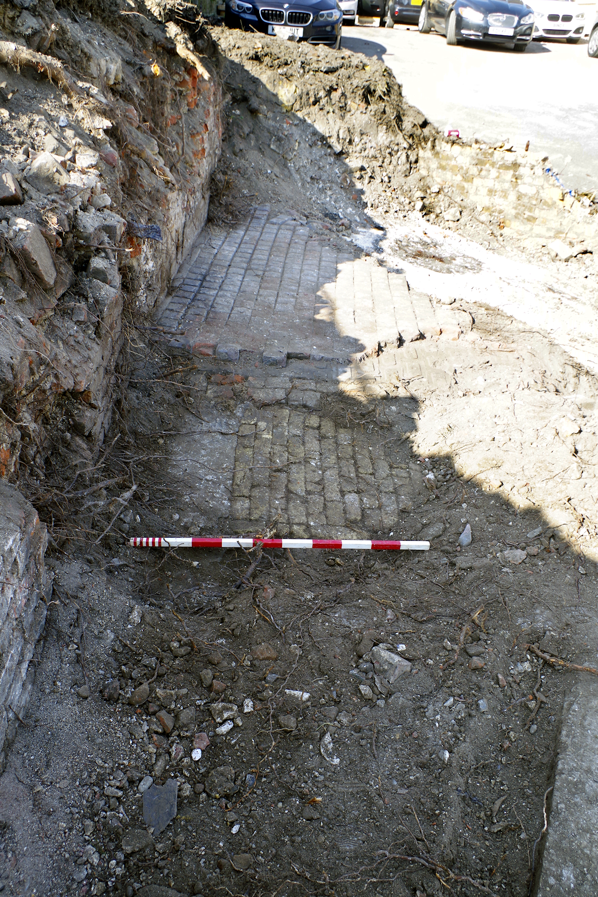
Figure 41: Coal chute in cellar wall 1113. 1 x 0.5m scale, 1 x 2m scale. View from we
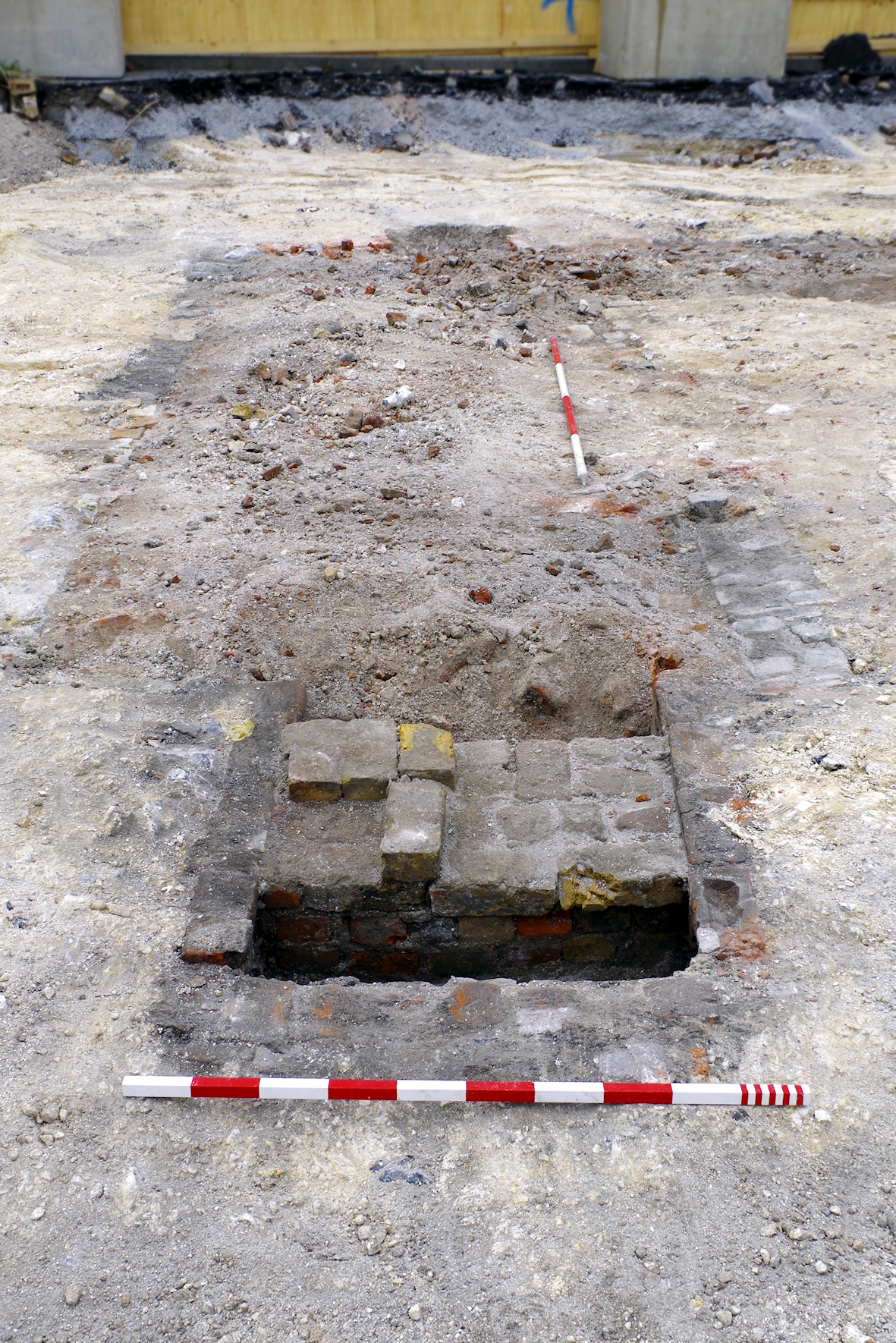
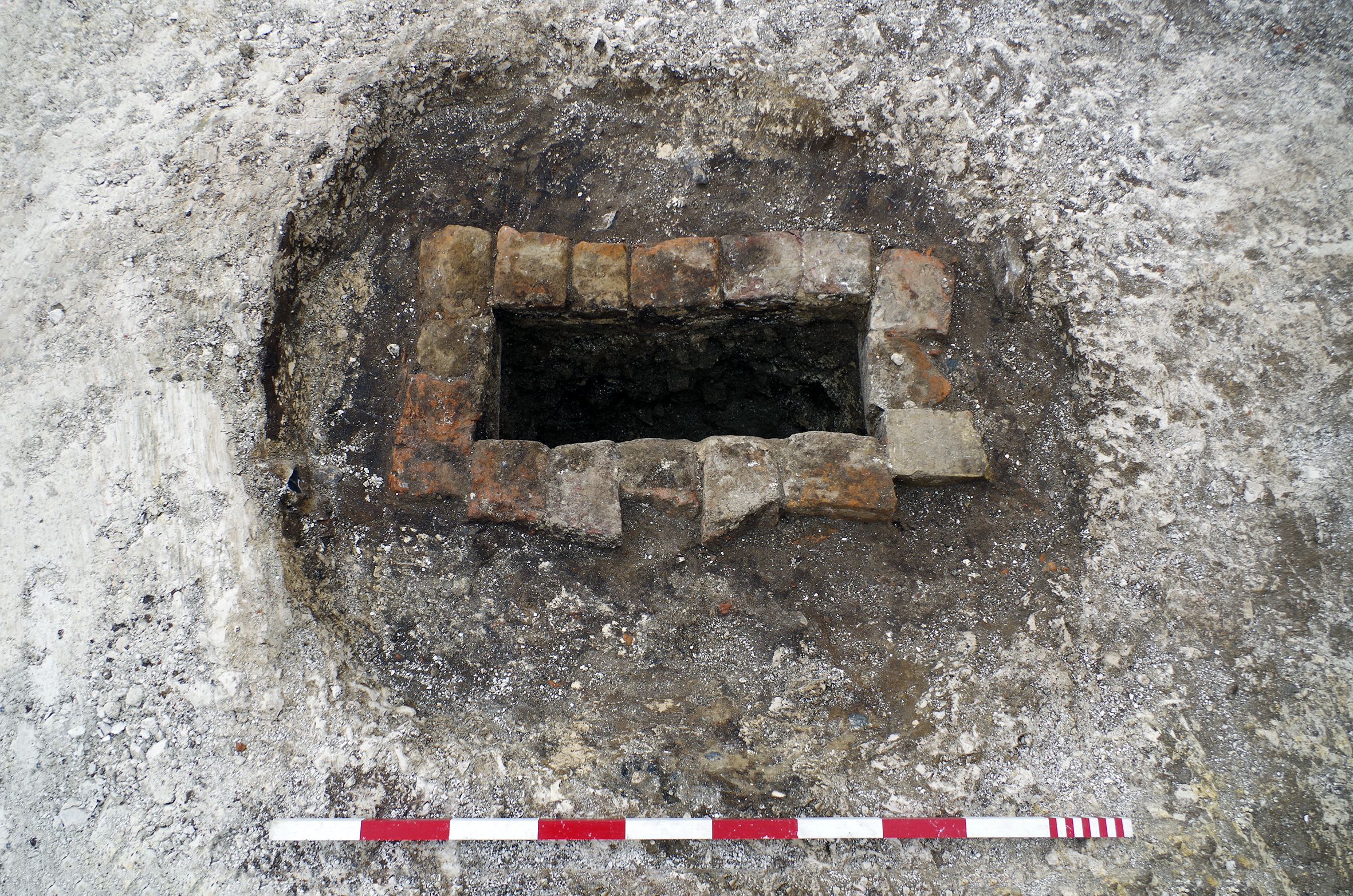
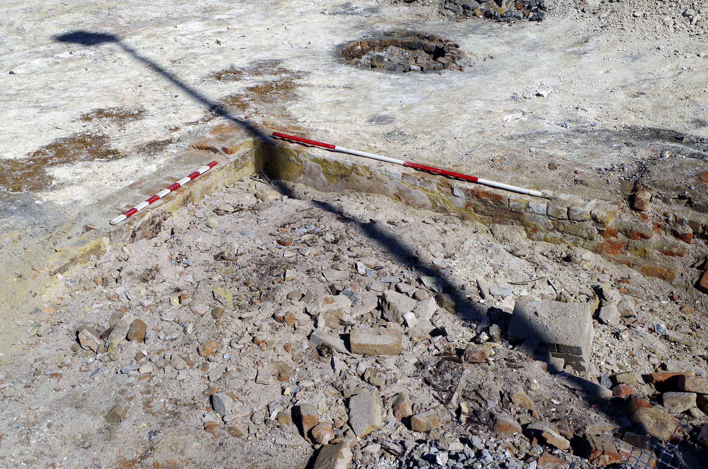
Figure 42: Privy 1084. 1 x 0.5m scale, 1 x 1m scale. View from south
Figure 43: Cellars 1119-1121. 2 x 2m scales. View from north
CgMs 2018 'Archaeological Desk Based Assessment: Eastern Quarter, Gravesend, Kent', unpublished document.
Discover Gravesham 2023a 'The High Street', Discover Gravesham [website], Gravesham Borough Council. https://www.discovergravesham.co.uk/gravesend/the-high-street.html [Last accessed: July 2023].
Discover Gravesham 2023b "Russell's Gravesend Brewery", , Discover Gravesham [website], Gravesham Borough Council. https://www.discovergravesham.co.uk/business-industry/russell-s-gravesend-brewery.html [Last accessed: September 2023].
Discover Gravesham 2023c '1712-1756', Discover Gravesham [website], Gravesham Borough Council. https://www.discovergravesham.co.uk/gravesend-chronology/1873-1889.html [Last accessed: July 2023].
Discover Gravesham 2023d 'Images Through Time: Gravesend Market', Discover Gravesham [website], Gravesham Borough Council. https://www.discovergravesham.co.uk/images-through-time-gravesend-market.html [Last accessed: September 2023].
Discover Gravesham 2023e 'The High Street', Discover Gravesham [website], Gravesham Borough Council. https://www.discovergravesham.co.uk/gravesend/the-high-street.html [Last accessed: July 2023].
Discover Gravesham 2023f 'The High Street', Discover Gravesham [website], Gravesham Borough Council. https://www.discovergravesham.co.uk/gravesend/the-high-street.html [Last accessed: July 2023].
Discover Gravesham 2023g "New Pier and Watermen's Riot", Discover Gravesham [website], Gravesham Borough Council. https://www.discovergravesham.co.uk/the-river/new-piers-and-the-watermens-riot.html [Last accessed: July 2023].
Dover Kent Archives 2021 'The Great Fire at Gravesend. June 1844', Dover-Kent.com [website], 7 March, 2021. http://www.dover-kent.com/2017-project/1844-Fire-Gravesend.html [Last accessed: September 2023].
Elks, K. 2016 'Gravesend', Kent Ginger Beer Stoneware Bottles, 2 June 2016, kenelks.co.uk [website], https://www.kenelks.co.uk/kentgingerbeer/gravesend.htm [Last accessed: September 2023].
Gravesend and Milton Directory 1851 Gravesend and Milton Directory. https://specialcollections.le.ac.uk/digital/collection/p16445coll4/id/180256/rec/3 [Last accessed: July 2023].
Kelly and Co. 1855 Post Office Directory of Essex, Herts, Kent, Middlesex, Surrey and Sussex, London: Kelly and Co. https://specialcollections.le.ac.uk/digital/collection/p16445coll4/id/365512/rec/2 [Last accessed: July 2023].
Kelly, E.R. (ed) and Co. 1882 Kelly's Directory of Kent. https://specialcollections.le.ac.uk/digital/collection/p16445coll4/id/278596/rec/2 [Last accessed: July 2023].
Kelly, E.R. (ed) and Co. 1891 Kelly's Directory of Kent, Surrey and Sussex (3rd Edition). https://specialcollections.le.ac.uk/digital/collection/p16445coll4/id/167110/rec/2 and https://specialcollections.le.ac.uk/digital/collection/p16445coll4/id/167105/rec/1 [Last accessed: July 2023].
Kelly's Directories Ltd 1903 Kelly's Directory of Kent. London: Kelly's Directories Ltd. https://specialcollections.le.ac.uk/digital/collection/p16445coll4/id/321788/rec/3 [Last accessed: July 2023].
Kelly's Directories Ltd 1913 Kelly's Directory of Kent, Surrey and Sussex. London: Kelly's Directories Ltd. https://specialcollections.le.ac.uk/digital/collection/p16445coll4/id/8910/rec/3 [Last accessed: July 2023].
Kent Archaeological Society n.d. 'Milton next Gravesend Tithe award schedule signed 8th June 1840', Kent Archaeological Society, kentarchaeology.org.uk [website]. https://kentarchaeology.org.uk/research/tithes/milton-next-gravesend [Last accessed: September 2023].
Kent Underground Research Group 2001 'Caves and Tunnels in South East England Part 15', Kent County Council Heritage 2002/176, unpublished document.
Melville, F. R. and Co. 1858 Mellville and Co.'s Directory and Gazetteer of Kent, London: W.H. Collingridge. https://specialcollections.le.ac.uk/digital/collection/p16445coll4/id/190501/rec/1 [Last accessed: July 2023].
Nevell, M. 2022 "Industrial workers' housing in Britain" in E.C. Casella, M. Nevell and H. Steyne (eds) The Oxford Handbook of Industrial Archaeology, Oxford: Oxford University Press. 507-528. https://doi.org/10.1093/oxfordhb/9780199693962.013.32
Pigot and Co. 1824 Pigot's Directory of Kent. https://specialcollections.le.ac.uk/digital/collection/p16445coll4/id/180636/rec/1 [Last accessed: July 2023].
Preston, J. 1995 'Industry 1800-1914' in A. Armstrong (ed) The Economy of Kent 1640-1914. Kent County Council, Boydell Press.
Prisley Chimney Sweeps n.d. 'Prisley Chimney Sweeps' Chimney Sweep History', Prisley Chimney Sweeps. https://www.prisleychimneysweepskent.co.uk/about-us [Last accessed: July 2023].
The Quack Doctor 2023 "Eno's Fruit Salt", thequackdoctor.com [website]. https://thequackdoctor.com/index.php/enos-fruit-salt/ [Last accessed: August 2023].
Tuck, A. 2023 "Marshall's A and B Mills - early industrial flax production in Leeds", CBA Yorkshire Forum 9, 204-32. https://www.cba-yorkshire.org.uk/forum-archive/ [Last accessed: September 2023].
Waterman Energy, Environment and Design 2012 'Preliminary Environmental Risk Assessment Gravesend Heritage Quarter', unpublished client report.
Wessex Archaeology 2020a 'Eastern Quarter - Gravesend Car Park, Gravesend, Kent: archaeological evaluation', unpublished report ref. 233910.1
Wessex Archaeology 2020b 'The Chater, Gravesend Car Parks, Gravesend, Kent: Written Scheme of Investigation for Archaeological Strip, Map and Sample Excavation', unpublished report ref. 233911.1
Wessex Archaeology 20he Charter, Gravesend Car Parks, Gravesend, Kent: Post-excavation Assessment and Updated Project Design', unpublished report ref. 233911.3
Internet Archaeology is an open access journal based in the Department of Archaeology, University of York. Except where otherwise noted, content from this work may be used under the terms of the Creative Commons Attribution 3.0 (CC BY) Unported licence, which permits unrestricted use, distribution, and reproduction in any medium, provided that attribution to the author(s), the title of the work, the Internet Archaeology journal and the relevant URL/DOI are given.
Terms and Conditions | Legal Statements | Privacy Policy | Cookies Policy | Citing Internet Archaeology
Internet Archaeology content is preserved for the long term with the Archaeology Data Service (ROR). Help sustain and support open access publication by donating to our Open Access Archaeology Fund.
 Home
Home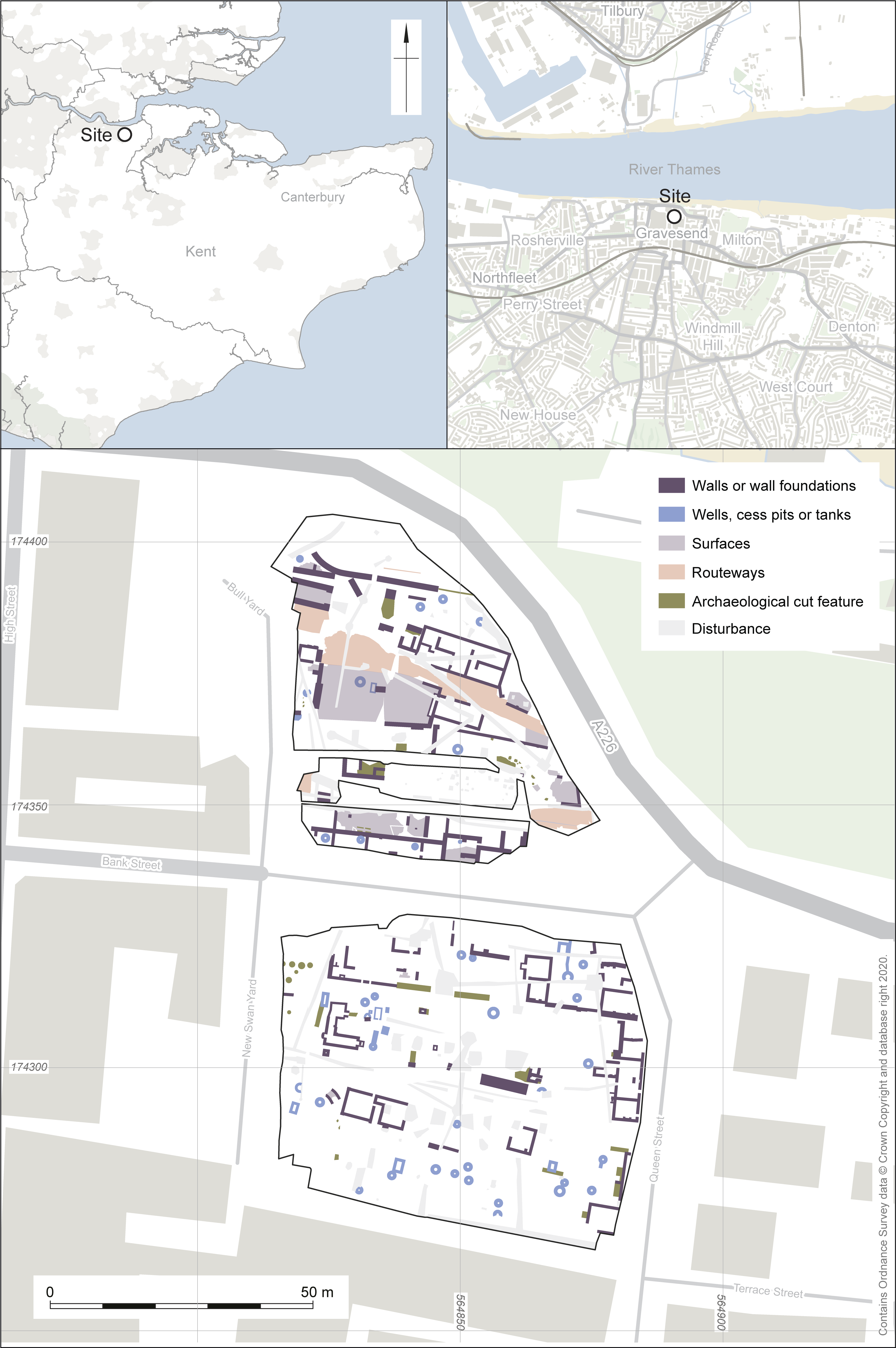